McPhail Fonds
Pages
-
-
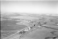
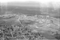
Anglia
-
Aerial photograph of Anglia, a hamlet in north east Saskatchewan.
-
-
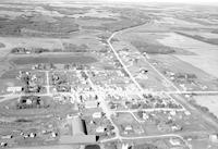
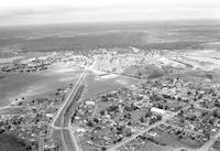
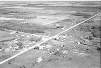
Angusville
-
Aerial photograph of Angusville, a community in the Parkland Region of Manitoba.
-
-
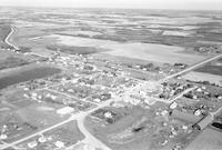
Angusville
-
Aerial photograph of Angusville, a community in the Parkland Region of Manitoba.
-
-
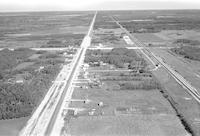
Anola
-
Aerial photograph of Anola, a community in eastern Manitoba.
-
-
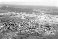
Ansonville
-
Aerial photograph of Ansonville, a community in Ontario.
-
-
Ansonville
-
Aerial photograph of Ansonville, a community in Ontario.
-
-
Ansonville
-
Aerial photograph of Ansonville, a community in Ontario.
-
-
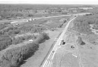
Antelope
-
Aerial photograph of a small hamlet with grain elevators, railway tracks. and cropland and a highway with a horse drawn vehicle.
-
-
Anviens
-
Aerial photograph of Anviens, Saskatchewan.
-
-
Arborg
-
Aerial photograph of a station south of Arborg, a town in the Interlake Region of Manitoba.
-

-
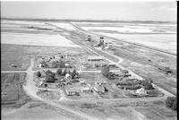
Arbuthnot
-
Aerial photograph of a small hamlet. Two grain elevators next to a set of railroad tracks are situated to the right side. An expanse of farmland is visible in the background. This image was featured on page 103 of the 2010 publication entitled "Portraits of an Era; The Aerial Photography of Howdy McPhail", written by Bill Waiser and published by Fifth House.
-
-
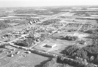
Archerwill
-
Aerial photograph of Archerwill, a community in northeast Saskatchewan.
Pages
