Settlement Stories: Setting the Stage for Ghost Towns
Saskatchewan now has so many ghost towns partially because it had so many small communities to begin with. It developed as a firmly rural-based province, settled with the intent of building the wheat farming industry. The promise of free farmland drew homesteaders to Saskatchewan, and the land was advertised abroad in Europe and the United States. Indigenous residents had been displaced to reserves by the government, and under the Dominion Lands Act of 1872, parcels of 160 acres could be secured for a ten-dollar fee, with additional acres available for a dollar apiece. Cultivation of crops or livestock was required of homesteaders for the first three years of their tenure on the homestead, after which time they could apply for a patent to the land. This practice was prevalent from 1883 until the last homestead was parcelled out in 1939.
Thanks in part to this practice, in the early 1900s the population of Saskatchewan was booming. From 1891 to 1901, the population grew 127 percent (from 41,522 to 91,279), reaching 257,763 people by 1906. By the 1920s, the population had surpassed 921,000, making Saskatchewan the third most populous province in Canada. The economy of the province was dependent on the agriculture industry, particularly the wheat farming that took place in southern Saskatchewan. The scale of the industry was remarkable, and along with it grew the infrastructure needed to support it, including the rail lines and grain elevators that traversed the prairie and dotted the landscape at regular intervals. The expansion of the wheat industry was encouraged and supported by both provincial and federal governments, and funded in part by the investments of powerful companies.
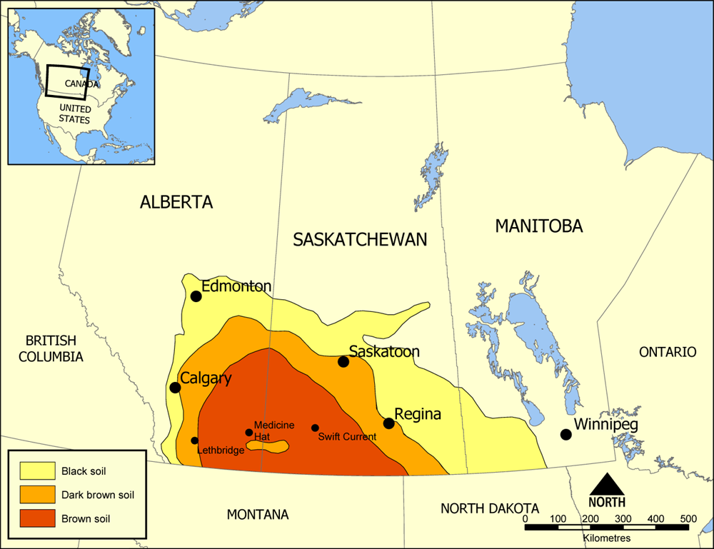
By 1914, half of the wheat grown in Canada was produced in Saskatchewan. Many towns, villages, and hamlets sprang up across the province to support the increasingly commercialized agriculture industry. However, the province's initial prosperity was dealt a severe blow in subsequent years. The land divisions effectuated by the Dominion Lands Act had resulted not only in an unsustainably scattered population but had also failed to account for the quality of the land in question. Much of the southern part of the province is part of the area known as Palliser's Triangle, designated as arid, semi-desert land unsuitable for agriculture by early expeditions. Despite this classification, the area was settled like the rest of the province, but farmers soon realized that making a living from this land was much more difficult.
https://commons.wikimedia.org/wiki/File:Palliser%27s_Triangle_map.png#/m...
Canadian portions of Palliser's Triangle
- Sources
-
Dick, Lyle. “Factors Affecting Prairie Settlement: A Case Study of Abernethy, Saskatchewan, in the 1880s.” Historical Papers, vol. 20, no. 1, 1985, p. 11.
Friesen, Gerald. "History of Settlement in the Canadian Prairies". The Canadian Encyclopedia, 01 June 2018, Historica Canada. thecanadianencyclopedia.ca/en/article/prairie-west.
Moore, Frank. Saskatchewan Ghost Towns. First Impressions, 1982.
Waiser, Bill. “The Tale of Two Different Futures: Saskatchewan in 1905 and 2005.” Canadian Issues, 2005, pp. 18–20. ProQuest, search.proquest.com/docview/208679495?rfr_id=info%3Axri%2Fsid%3Aprimo.
