McPhail Fonds
Pages
-
-
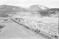
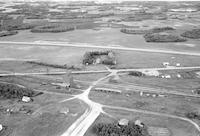
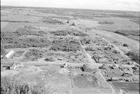
Burmis?
-
Aerial photograph of Burmis, a community in Southern Alberta.
-
-
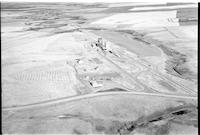
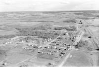
Burnham
-
Aerial photograph of a hamlet with 2 grain elevators, a farm house, roads and an expanse of agricultural land in the background.
-
-
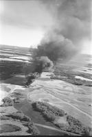
Burning Oilwell
-
Aerial photograph of a burning oil well west of the City of Red Deer, Alberta.
-
-
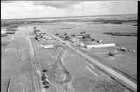
Burr
-
Aerial photograph of a small town containing two grain elevators. An expanse of farmland is visible in the background.
-
-
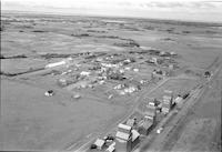
Burrows
-
Aerial photograph of Burrows, a community in south east Saskatchewan.
-
-
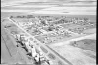
Burstall
-
Aerial photograph of a small town containing several grain elevators. An expanse of farmland is visible in the background.
-
-
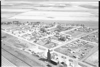
Burstall
-
Aerial photograph of a small town containing two grain elevators. An expanse of farmland is visible in the background.
-
-
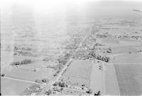
Burtch or Mt. Pleasant
-
Aerial photograph of a community in the County of Brant, Southern Ontario. A wing of the airplane is visible in the upper right side of the image.
-
-
Busby
-
Aerial photograph of Busby, a small hamlet in Central Alberta.
-
-
Busby
-
Aerial photograph of Busby, a small hamlet in Central Alberta.
-
-
Byemoor
-
Aerial photograph of Byemoor, a hamlet in Central Alberta, north of Carstairs.
-
-
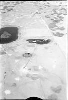
CFQC TV Tower
-
Aerial photograph of a television broadcast tower in the middle of a stretch of prairie. A road or highway passes by the tower on the right. A couple of slews are visible near the center of the image.
Pages
