McPhail Fonds
Pages
-
-
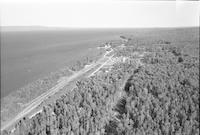
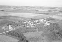
Canyon Creek
-
Aerial photograph of Canyon Creek, British Columbia, 4 miles west of Wagner.
-
-
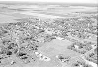
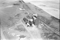
Carberry
-
Aerial photograph of Carberry, a town in southwestern Manitoba.
-
-
Cardinal
-
Aerial photograph of Cardinal, a community in the Pembina Valley of Manitoba.
-
-
Cardinal
-
Aerial photograph of Bruxelles, community 15 miles west of Cardinal in southern Manitoba. A portion of the wing of the airplane is visible in the left side of the photograph.
-
-
Cardinal
-
Aerial photograph of Bruxelles, community 15 miles west of Cardinal in southern Manitoba.
-
-
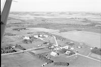
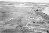
Cardross
-
Aerial photograph of Cardross, a hamlet in south central Saskatchewan.
-
-
Cardross
-
Aerial photograph of Cardross, a hamlet in south central Saskatchewan.
-
-
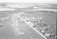
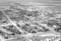
Cardston
-
Aerial photograph of Cardston, a town in Southern Alberta.
-
-
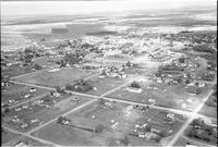
Cardston
-
Aerial photograph of Cardston, a town in Southern Alberta.
-
-
Cardston
-
Aerial photograph of Cardston, a town in Southern Alberta.
-
-
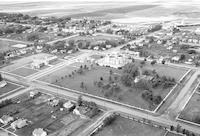
Cardston
-
Aerial photograph of Cardston, a town in southwest Alberta, containing the Cardston Alberta Temple. An expanse of farmland is visible in the background.
-
-
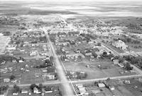
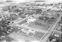
Cardston
-
Aerial photograph of Cardston, a town in southwest Alberta, containing the Cardston Alberta Temple at the center of the image. A church is visible in the foreground. An expanse of farmland is visible in the background., Appears in Waiser, W. A., and McPhail, H. D. Portraits of an Era: The Aerial Photography of Howdy McPhail. University Authors Collection. United States: Fifth House, 2010, p. 131.
Pages
