McPhail Fonds
Pages
-
-
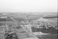
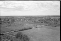
Crossfield
-
Aerial photograph of Crossfield, a town in Southern Alberta.
-
-
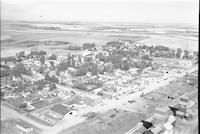
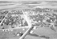
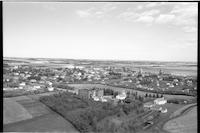
Crossfield
-
Aerial photograph of Crossfield, a town in Southern Alberta, containing two grain elevators. An expanse of farmland is visible in the background.
-
-
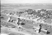
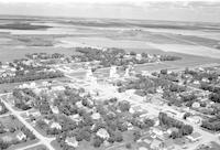
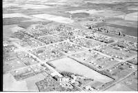
Crossfield
-
Aerial photograph of Crossfield, a town in Southern Alberta, containing three grain elevators. An expanse of farmland is visible in the background.
-
-
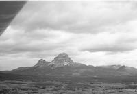
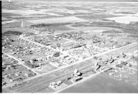
Crow's Nest
-
Aerial photograph of Crownest Mountain in southwestern Alberta. The mountain is part of the Crownest Range of the Canadian Rocky Mountains and has an elevation of 2,785 m (9,137 ft)., The finding aid classifies this as a photograph of British Columbia, where McPhail may have been flying when he took the photo given that the mountain is located by the Alberta-British Columbia border.
-
-
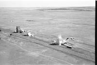
Crowfoot
-
Aerial photograph of Crowfoot, a locality in Southern Alberta, containing three grain elevators surrounded by farmland.
-
-
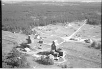
Crutwell
-
Aerial photograph of a small hamlet with two grain elevators. An expanse of forest is visible in the background.
-
-
Crystal City
-
Aerial photograph of Crystal City, a community in southern Manitoba.
-
-
Crystal City
-
Aerial photograph of Crystal City, a community in southern Manitoba.
-
-
Cudworth
-
Aerial photograph of a small town surrounded by farmland.
-
-
Cudworth
-
Aerial photograph of a small town containing several grain elevators. An expanse of farmland is visible in the background.
-
-
Cudworth
-
Aerial photograph of a small town containing several grain elevators. An expanse of farmland is visible in the background.
-
-
Cudworth
-
Aerial photograph of a small town containing several grain elevators. An expanse of farmland is visible in the background.
Pages
