Search results
Pages
-
-
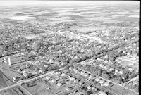
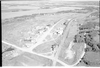
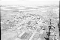
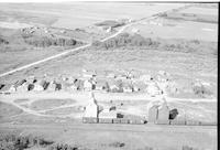
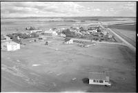
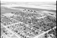
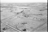
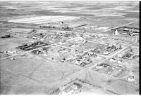
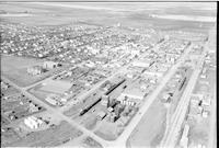
Title
-
Neepawa
-
Description
-
Aerial photograph of Neepawa, a small town in western Manitoba.
-
Date
-
1956
-
-
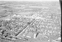
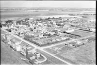
Title
-
Neepawa
-
Description
-
Aerial photograph of Neepawa, a small town in western Manitoba.
-
Date
-
1956
-

-
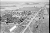
Title
-
Neepawa
-
Description
-
Aerial photograph of Neepawa, a small town in western Manitoba.
-
Date
-
1956
-
-
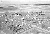
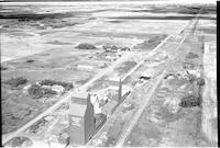
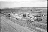
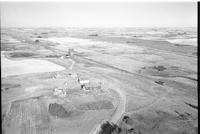
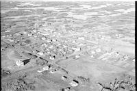
Title
-
New Dayton
-
Description
-
Aerial photograph of New Dayton, a hamlet in Southern Alberta.
-
Date
-
1956
-
-
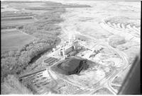
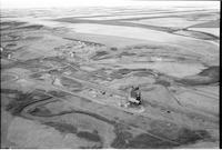
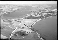
Title
-
Estevan
-
Description
-
Aerial photograph of a power plant near Estevan.
-
-
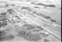
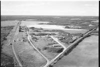
Title
-
Runnymede
-
Description
-
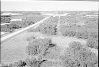
Aerial photograph of a hamlet. An expanse of farmland is visible in the background.
-
Date
-
, 1956
-
-
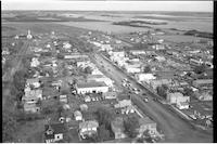
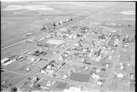
Title
-
Cut Knife
-
Description
-
Aerial photograph of a small town with dwellings, churches, grain elevators, railway, and agricultural land.
-
Date
-
, 1956
-
-
Title
-
Eatonia
-
Description
-
Aerial photograph of a small town surrounded by agricultural land. The main street and train tracks run parallel. Visible structures include a quonset, a church, and grain elevators.
-
-
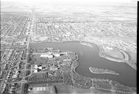
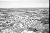
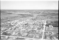
Title
-
Regina
-
Description
-
Aerial photograph of Regina with a view of endless houses, Wascana lake and the Saskatchewan Legislative Building.
-
-
Title
-
Coleville
-
Description
-
Aerial photograph of a small town, grain elevators, railway tracks, train station, water tower, church and agricultural land.
-
Date
-
, 1955
-
-
Title
-
Daphne
-
Description
-
Aerial photograph of a small hamlet with grain elevators a few dwellings, railway tracks and agricultural land in background.
-
-
Title
-
Prince
-
Description
-
Aerial photograph of a hamlet. An expanse of farmland is visible in the background.
-

-
Title
-
St. Walburg
-
Description
-
Aerial photograph of an agricultural town surrounded by farmland and lightly wooded prairie.
-
![Cochin [farms]](/islandora/object/mcphail%3A803/datastream/TN/view)
-
Title
-
Cochin [farms]
-
Description
-
Aerial photograph of an unidentified farm near Cochin.
-
-
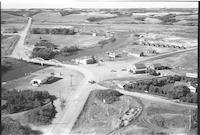
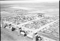
Title
-
Cut Knife
-
Description
-
Aerial photograph of a small town with churches, dwellings, vehicles on a main street, store fronts with a service station. Agricultural land in the background.
-
![Cochin [farms]](/islandora/object/mcphail%3A799/datastream/TN/view)
-
Title
-
Cochin [farms]
-
Description
-
Aerial photograph of an unidentified farm.
-

-
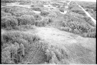
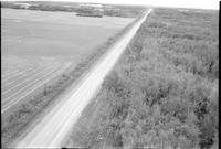
Title
-
Sask Power power lines
-
Description
-
Aerial photograph of Sask Power power lines. An expanse of dense forest surrounds the trail of pipeline.
-
-
Title
-
Carmichael
-
Description
-
Aerial photograph of a small town. Grain elevators, railway tracks and farmland are also visible.
-
-
Title
-
St. Walburg
-
Description
-
Aerial photograph of an agricultural town surrounded by farmland and wooded prairie.
-
-
Title
-
Biggar
-
Description
-
Aerial photograph of grain elevators, livestock corral, railway tracks and agricultural land.
-
-
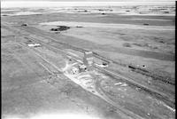
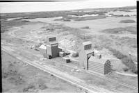
Title
-
Coppen
-
Description
-
Aerial photograph of unincorporated area with dwellings, grain elevators and an expanse of farmland.
-
Date
-
, 1955
-
-
Title
-
Runnymede
-
Description
-
Aerial photograph of a small hamlet. An expanse of farmland is visible in the background.
-
Date
-
, 1956
-
-
Title
-
Sask Power power lines
-
Description
-
Aerial photograph of Sask Power power lines. An expanse of dense forest surrounds the trail of power lines.
-
-
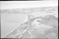
Title
-
Cochin
-
Description
-
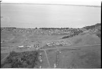
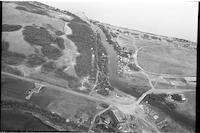
Aerial photograph of a resort village. Jackfish Lake or Murray Lake is in the distance.
-
-
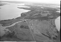
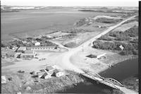
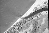
Title
-
Cochin
-
Description
-
Aerial photograph of a resort village. Jackfish Lake Narrows Bridge spans Lehman Creek, a channel that connects Jackfish Lake and Murray Lake.
-
-
Title
-
Primate
-
Description
-
Aerial photograph of a hamlet. An expanse of farmland is visible in the background.
-
![Cochin [farms]](/islandora/object/mcphail%3A819/datastream/TN/view)
-
Title
-
Cochin [farms]
-
Description
-
Aerial photograph of an unidentified farm. Large bodies of water lie on either side of the farm.
-
-
Title
-
Cochin
-
Description
-
Aerial photograph of a resort village. Jackfish Lake Narrows Bridge spans Lehman Creek, a channel that connects Jackfish Lake and Murray Lake.
-
-
Title
-
Eatonia
-
Description
-
Aerial photograph of a small town
-
-
Title
-
Richmound
-
Description
-
Aerial photograph of a village. An expanse of farmland is visible in the background.
-
Date
-
, 1956
-
-
Title
-
Browning
-
Description
-
Aerial photograph of a Hamlet with grain elevators, railway tracks, dwellingvs, a church and agricultural land in the background
-
Date
-
, 1955
-
-
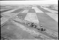
Title
-
Court
-
Description
-
Aerial photograph of a hamlet with grain elevators, farmland, dwellings, railway tracks and agricultural land in background.
-
-
Title
-
Dendron
-
Description
-
Aerial photograph of a small Hamlet, grain elevators farm houses and farmland with agricultural land visible in the background.
-
Date
-
, 1955
-
-
Title
-
St. Walburg
-
Description
-
Aerial photograph of an agricultural town with an expanse of farmland visible in the background.
-
![Cochin [farms]](/islandora/object/mcphail%3A823/datastream/TN/view)
-
Title
-
Cochin [farms]
-
Description
-
Aerial photograph of an unidentified farm near Cochin.
-
-
Title
-
Rush Lake
-
Description
-
Aerial photograph of a village. An expanse of farmland is visible in the background.
-
-
Title
-
Robinhood
-
Description
-
Aerial photograph of a hamlet. An expanse of farmland is visible in the background.
-
-
Title
-
Earl Grey
-
Description
-
Aerial photograph of a village surrounded by agricultural land. Grain elevators along the railroad and a church on the other side of town are visible.
-
Date
-
, 1955
-
-
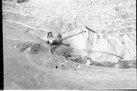
Title
-
Bienfait
-
Description
-
Aerial photograph of a crane, a few vehicles working. Sask Power shovel near Estevan
-
-
Title
-
Cochin
-
Description
-
Aerial photograph of a resort village. Jackfish Lake Narrows Bridge spans Lehman Creek, a channel that connects Jackfish Lake and Murray Lake.
-
-
Title
-
Rouleau
-
Description
-
Aerial photograph of a small town. An expanse of farmland is visible in the background.
-
Date
-
, 1956
-
-
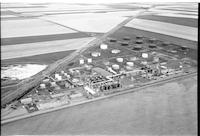
Title
-
Regina Co-op Refinery
-
Description
-
Aerial photograph of the Co-op Refinery in Regina. An expanse of farmland is visible in the background.
-
-
Title
-
Cochin
-
Description
-
Aerial photograph of a resort village. Jackfish Lake Narrows Bridge spans Lehman Creek, a channel that connects Jackfish Lake and Murray Lake.
-
-
Title
-
Cochin
-
Description
-
Aerial photograph of a resort village. A boat is on the lake, either Jackfish or Murray. A series of houses are along Lehman Creek, a channel that connects Jackfish Lake and Murray Lake.
-
-
Title
-
Rosetown
-
Description
-
Aerial photograph of a large town. An expanse of farmland is visible in the background.
-
Date
-
, 1956
-
-
Title
-
Rex
-
Description
-
Aerial photograph of two grain elevators next to a railroad. An expanse of wooded prairie and farmland is visible in the background.
-
Date
-
, 1956
-
-
Title
-
Sask Power power lines
-
Description
-
Aerial photograph of Sask Power power lines. An expanse of dense forest surrounds the trail of power lines.
-
-
Title
-
Sask Power power lines
-
Description
-
Aerial photograph of Sask Power power lines. An expanse of dense forest surrounds the trail of pipeline.
-
-
Title
-
Cochin
-
Description
-
Aerial photograph of an incorporated resort village with Jackfish Lake in the background.
-
-
Title
-
Cochin
-
Description
-
Aerial photograph of a resort village. Jackfish Lake Narrows Bridge spans Lehman Creek, a channel that connects Jackfish Lake and Murray Lake.
Pages


