Search results
Pages
-
-
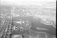
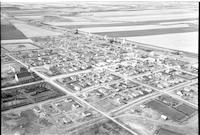
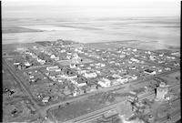
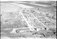
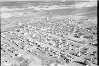
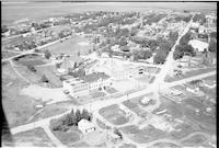
Title
-
Regina
-
Description
-
Aerial photograph of Regina with a view of endless houses, Wascana lake and the Saskatchewan Legislative Building.
-
-
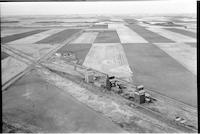
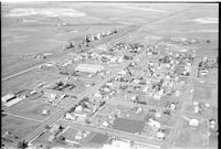
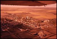
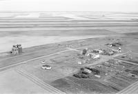
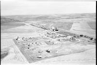
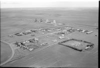
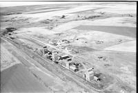
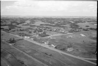
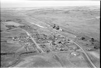
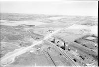
Title
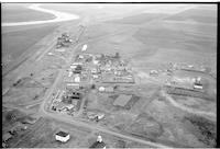
-
Coppen
-
Description
-
Aerial photograph of unincorporated area with dwellings, grain elevators and an expanse of farmland.
-
Date
-
, 1955
-
-
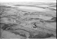
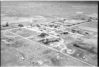
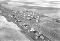
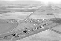
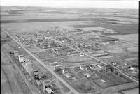
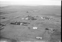
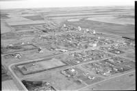
Title
-
Dendron
-
Description
-
Aerial photograph of a small Hamlet, grain elevators farm houses and farmland with agricultural land visible in the background.
-
Date
-
, 1955
-
-
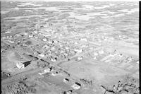
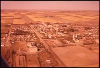
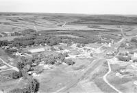
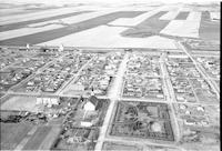
Title
-
Earl Grey
-
Description
-
Aerial photograph of a village surrounded by agricultural land. Grain elevators along the railroad and a church on the other side of town are visible.
-
Date
-
, 1955
-
-
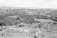
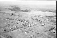
Title
-
Rouleau
-
Description
-
Aerial photograph of a small town. An expanse of farmland is visible in the background.
-
Date
-
, 1956
-
-
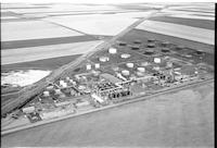
Title
-
Regina Co-op Refinery
-
Description
-
Aerial photograph of the Co-op Refinery in Regina. An expanse of farmland is visible in the background.
-
-
Title
-
Brownlee
-
Description
-
Aerial photograph of a small town with dwellings, grain elevators, churches, schools and agricultural land.
-
-
Title
-
Estlin
-
Description
-
Aerial photograph of Estlin, a hamlet in south central Saskatchewan.
-
Date
-
1958
-
-
Title
-
Gray
-
Description
-
Aerial photograph of Gray, a hamlet in southern Saskatchewan surrounded by farmland.
-
Date
-
1958
-
-
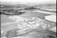
Title
-
Gravelbourg
-
Description
-
Aerial photograph of Gravelbourg, a town in central Saskatchewan. A portion of the airplane's wing is visible in the upper part of the image.
-
Date
-
1958
-
-
Title
-
Gravelbourg
-
Description
-
Aerial photograph of Gravelbourg, a town in central Saskatchewan.
-
Date
-
1958
-
-
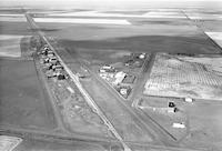
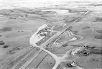
Title
-
Galilee
-
Description
-
Aerial photograph of a railroad siding in Galilee, a community in Saskatchewan.
-
Date
-
1957
-
-
Title
-
Hearne
-
Description
-
Aerial photograph of Hearne, a hamlet in central Saskatchewan. An expanse of farmland is visible in the background.
-
Date
-
1957
-
-
Title
-
Lewvan
-
Description
-
Aerial photograph of Lewvan, a community in southern Saskatchewan.
-
Date
-
1958
-
-
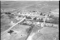
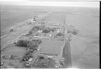
Title
-
Lumsden
-
Description
-
Aerial photograph of Lumsden, a town in central Saskatchewan.
-
Date
-
1957
-
-
Title
-
Lumsden
-
Description
-
Aerial photograph of Lumsden, a town in central Saskatchewan.
-
Date
-
1957
-

-
Title
-
Lang
-
Description
-
Aerial photograph of Lang, a village in south central Saskatchewan.
-
-
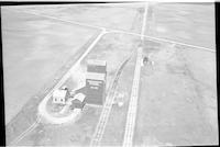
Title
-
Chaplin
-
Description
-
Aerial photograph of a salt plant. An expanse of lightly wooded prairie is visible in the background.
-
-
Title
-
Courval
-
Description
-
Aerial photograph of a small town containing two grain elevators. A church is visible towards the bottom of the image, and river is visible towards the top left, running through a stretch of farmland.
-
Date
-
, 1956
-
-
Title
-
Penzance
-
Description
-
Aerial photograph of an agricultural village. An expanse of farmland is visible in the background.
-
-
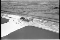
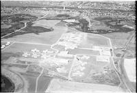
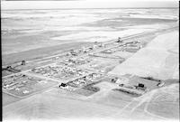
Title
-
Moose Jaw: School for the Mentally Deficient
-
Description
-
Aerial photograph of the School for the Mentally Deficient, later called the Saskatchewan Training School and Valley View Centre, near Moose Jaw. Since the facility opened in 1955, the buildings seen are quite new. The city of Moose Jaw and the Moose Jaw River are visible to the north, and there is an expanse of farm land to the east.
-
-
Title
-
LaFleche
-
Description
-
Aerial photograph of a hamlet with a beautiful park in the bottom left hand side of the photograph.
-
Date
-
, 1955
-
-
Title
-
Horizon
-
Description
-
Aerial photograph of a hamlet surrounded by farm land. The dominant features are a church, several grain elevators, and the railroad.
-
Date
-
, 1955
-
-
Title
-
Moose Jaw: School for the Mentally Deficient
-
Description
-
Aerial photograph of the School for the Mentally Deficient, later called the Saskatchewan Training School and Valley View Centre, near Moose Jaw. Since the facility opened in 1955, the buildings seen are quite new. The city of Moose Jaw and the Moose Jaw River are visible to the north.
-
-
Title
-
Limerick
-
Description
-
Aerial photograph of a small town with churches, dwellings, grain elevators, railway tracks and a school. Agricultural land is visible in the background.
-
Date
-
, 1955
-
![Willowbunch [Willow Bunch]](/islandora/object/mcphail%3A1296/datastream/TN/view)
-
Title
-
Willowbunch [Willow Bunch]
-
Description
-
Aerial photograph of a small community with gentle, rolling hills behind it.
-
Date
-
, 1955
-
-
Title
-
Vantage
-
Description
-
Aerial photograph of hamlet with a vast expanse of farmland in the background.
-
Date
-
, 1956
-

-
Title
-
Shelbrook
-
Description
-
Aerial photograph of a well-sized rural community. An expanse of farmland is visible in the background.
-
-
Title
-
Uren
-
Description
-
Aerial photograph of a small rural community surrounded by farmland.
-
-
Title
-
Expanse
-
Description
-
Aerial photograph of an unincorporated area near a body of water.
-
Date
-
, 1956
-
-
Title
-
Pense
-
Description
-
Aerial photograph of an agricultural village. An expanse of farmland is visible in the background.
-

-
Title
-
Penzance
-
Description
-
Aerial photograph of an agricultural village. An expanse of farmland is visible in the background.
-

-
Title
-
Melaval
-
Description
-
Aerial photograph of a small hamlet surrounded by farm land.
-
Date
-
, 1955
-

-
Title
-
Tompkins
-
Description
-
Aerial photograph of a village with a large church in the foreground.
-
-
Title
-
Verwood
-
Description
-
Aerial photograph of a hamlet with a large church in the background.
-
Date
-
, 1955
-
-
Title
-
Willows
-
Description
-
Aerial photograph of a hamlet sloping down towards a valley.
-
Date
-
, 1955
-
-
Title
-
Melaval
-
Description
-
Aerial photograph of a small hamlet surrounded by farm land.a
-
Date
-
, 1955
-
![Willowbunch [Willow Bunch]](/islandora/object/mcphail%3A1309/datastream/TN/view)
-
Title
-
Willowbunch [Willow Bunch]
-
Description
-
Aerial photograph of a small community surrounded by farm land. Grain elevators and the school are easily visible.
-
Date
-
, 1955
-
-
Title
-
Shamrock
-
Description
-
Aerial photograph of a farming community surrounded by an expanse of farmland.
-
Date
-
, 1956
-
-
Title
-
Silton
-
Description
-
Aerial photograph of a small agricultural community. An expanse of farmland dispersed among small tree stands is visible in the background.
-
Date
-
, 1957
-
-
Title
-
Limerick
-
Description
-
Aerial photograph of a small town with churches, dwellings, grain elevators, railway tracks and a school. Agricultural land is visible in the background.
-
Date
-
, 1955
-
-
Title
-
LaFleche
-
Description
-
Aerial photograph of a small town with churches, school, dwellings, grain elevators and agricultural land visible in background.
-
Date
-
, 1955
-
-
Title
-
Trossachs
-
Description
-
Aerial photograph of hamlet with expansive farmland in the background, and a cluster of trees to the left.
-
Date
-
, 1955
-
-
Title
-
Strasbourg
-
Description
-
Aerial photograph of a rural town surrounded by farmland.
-
Date
-
, 1955
-
![Willowbunch [Willow Bunch]](/islandora/object/mcphail%3A1368/datastream/TN/view)
-
Title
-
Willowbunch [Willow Bunch]
-
Description
-
Aerial photograph of a small community with some rolling hills in the distance.
-
Date
-
, 1955
-
-
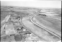
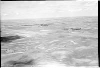
Title
-
Radville
-
Description
-
Aerial photograph of the prairie landscape south of Radville.
-
Date
-
, 1956
-
-
Title
-
Abbott
-
Description
-
Aerial photograph of an unincorporated area surrounded by farmland.
-
Date
-
, 1956
-
-
Title
-
Readlyn
-
Description
-
Aerial photograph of a hamlet surrounded by hills and farmland.
-
Date
-
, 1955
-
-
Title
-
Radville
-
Description
-
Aerial photograph of a town with two large institutions in the centre.
-
Date
-
, 1956
-
-
Title
-
Secretan
-
Description
-
Aerial photograph of a small agricultural community. An expanse of farmland is visible in the background.
Pages


