Search results
-

-
Title
-
Whiskey Gap
-
Description
-
Aerial photograph of Whiskey Gap, a former town in Southern Alberta, containing three grain elevators surrounded by farmland.
-
Date
-
1956
-
-
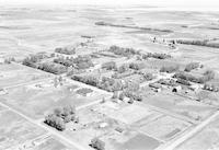
Title
-
Glenwood
-
Description
-
Aerial photograph of Glenwood, a village in Southern Alberta.
-
Date
-
1957
-
-
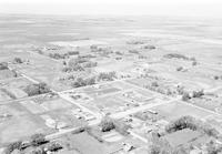
Title
-
Hill Spring
-
Description
-
Aerial photograph of Hill Spring, a village in Southern Alberta.
-
Date
-
1957
-
-
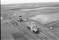
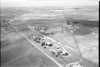
Title
-
Bradshaw
-
Description
-
Aerial photograph of Bradshaw, a locality in Southern Alberta, containing two grain elevators surrounded by farmland.
-
-
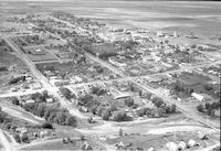
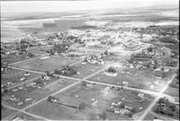
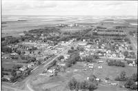
Title
-
Cardston
-
Description
-
Aerial photograph of Cardston, a town in Southern Alberta.
-
Date
-
1956
-
-
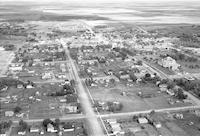
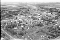
Title
-
Cardston
-
Description
-
Aerial photograph of Cardston, a town in Southern Alberta.
-
Date
-
1956
-
-
Title
-
Cardston
-
Description
-
Aerial photograph of Cardston, a town in Southern Alberta.
-
Date
-
1956
-
-
Title
-
Del Bonita
-
Description
-
Aerial photograph of Del Bonita, a hamlet in Southern Alberta.
-
Date
-
1956
-
-
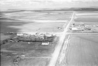
Title
-
Jefferson
-
Description
-
Aerial photograph of Jefferson, an unincorporated community in Southern Alberta, containing three grain elevators.
-
Date
-
1956
-
-
Title
-
Magrath
-
Description
-
Aerial photograph of Magrath, a town in Southern Alberta, including several grain elevators. An expanse of farmland is visible in the background.
-
Date
-
1956
-
-
Title
-
Magrath
-
Description
-
Aerial photograph of Magrath, a town in Southern Alberta. An expanse of farmland is visible in the background.
-
Date
-
1956
-
-
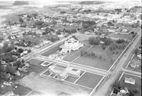
Title
-
Cardston
-
Description
-
Aerial photograph of Cardston, a town in southwest Alberta, containing the Cardston Alberta Temple at the center of the image. A church is visible in the foreground. An expanse of farmland is visible in the background.
-
-
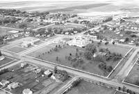
Title
-
Cardston
-
Description
-
Aerial photograph of Cardston, a town in southwest Alberta, containing the Cardston Alberta Temple. An expanse of farmland is visible in the background.


