Error message
Warning: count(): Parameter must be an array or an object that implements Countable in theme_pager_link() (line 637 of /opt/rh/httpd24/root/var/www/html/drupal/web/includes/pager.inc).
Search results
Pages
-
-
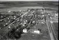
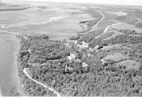
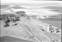
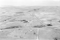
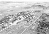
Title
-
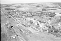
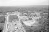
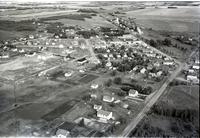
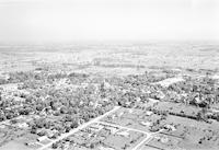
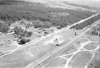
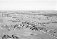
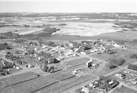
MacGregor
-
Description
-
Aerial photograph of MacGregor, a community in the Central Plains Region of Manitoba, including two grain elevators. An expanse of farmland is visible in the background.
-
Date
-
1956
-
-
Title
-
Loyalist
-
Description
-
Aerial photograph of Loyalist, a locality in Central Alberta, including grain elevators.
-
Date
-
1956
-
-
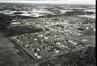
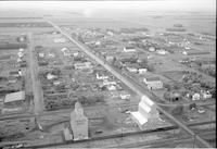
Title
-
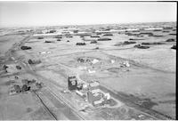
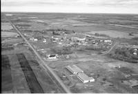
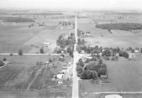
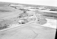
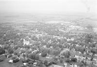
Lougheed
-
Description
-
Aerial photograph of Lougheed, a village in Central Alberta, including grain elevators and agricultural land in the background.
-
-
Title
-
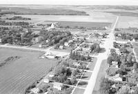
Linden
-
Description
-
Aerial photograph of Linden, a village in Central Alberta. An expanse of farmland is visible in the background.
-
Date
-
1956
-
-
Title
-
Lodgepole
-
Description
-
Aerial photograph of Lodgepole, a hamlet in Central Alberta.
-
Date
-
1957-07
-
-
Title
-
Loyalist
-
Description
-
Aerial photograph of Loyalist, a locality in Central Alberta, including grain elevators.
-
-
Title
-
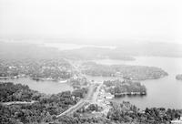
Ma-Me-O Beach
-
Description
-
Aerial photograph of Ma-Me-O Beach, a summer village in Central Alberta located on the shore of Pigeon Lake.
-
-
Title
-
McLennan
-
Description
-
Aerial photograph of McLennan, a town in Northern Alberta. The Cathédrale Saint-Jean-Baptiste is visible.
-
Date
-
1956
-
-
Title
-
McCreary
-
Description
-
Aerial photograph of McCreary, a community in the Parkland Region of Manitoba. An expanse of farmland is visible in the background.
-
Date
-
1956
-
-
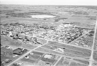
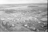
Title
-
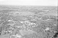
Mayerthorpe
-
Description
-
Aerial photograph of Mayerthorpe, a town in Central Alberta.
-
-
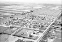
Title
-
Mannville
-
Description
-
Aerial photograph of Mannville, a village in Central Alberta, containing several grain elevators. A body of water is visible in the background.
-
-
Title
-
Marquette
-
Description
-
Aerial photograph of Marquette, a community in the Interlake Region of Manitoba, containing two grain elevators. An expanse of farmland is visible in the background.
-
Date
-
1956
-
-
Title
-
Marwayne
-
Description
-
Aerial photograph of Marwayne, a village in Central Alberta, containing several grain elevators.
-
Date
-
1956
-
-
Title
-
New Sarepta
-
Description
-
Aerial photograph of New Sarepta, a hamlet in the Edmonton Capital Region of Alberta.
-
Date
-
1956
-
-
Title
-
Ninette
-
Description
-
Aerial photograph of Ninette, a community in western Manitoba, containing one grain elevator. An expanse of farmland is visible in the foreground and in the background.
-
Date
-
1957
-
-
Title
-
Ninette
-
Description
-
Aerial photograph of Ninette, a community in western Manitoba, containing one grain elevator. A stretch of Pelican Lake is visible in the foreground. An expanse of farmland is visible in the background.
-
Date
-
1957
-
-
Title
-
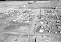
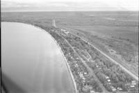
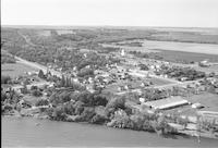
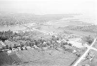
Ninette
-
Description
-
Aerial photograph of the Ninette Sanatorium in Manitoba. Pelican Lake is visible in the left side of the photograph.
-
Date
-
1957
-

-
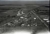
Title
-
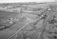
Nisku
-
Description
-
Aerial photograph of Nisku, a hamlet and an industrial park in Alberta, containing three grain elevators. A service station is visible in the foreground. An expanse of farmland is visible in the background.
-
-
Title
-
Niverville
-
Description
-
Aerial photograph of Niverville, a town in eastern Manitoba. An expanse of farmland is visible in the background.
-
Date
-
1956
-
-
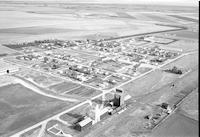
Title
-
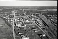
Nobleford
-
Description
-
Aerial photograph of Nobleford, a town in Southern Alberta containing several grain elevators. An expanse of farmland is visible in the background.
-
Date
-
1956
-
-
Title
-
Nobleford
-
Description
-
Aerial photograph of Nobleford, a town in Southern Alberta, containing two grain elevators in the foreground. An expanse of farmland is visible in the background.
-
Date
-
1956
-
-
Title
-
Oakland
-
Description
-
Aerial photograph of Oakland, Manitoba, containing two grain elevators. An expanse of farmland is visible in the background.
-
Date
-
1956
-
-
Title
-
Oakville
-
Description
-
Aerial photograph of Oakville, a community in the Central Plains Region of Manitoba, containing several grain elevators. An expanse of farmland is visible in the background.
-
Date
-
1956
-
-
Title
-
Plamondon
-
Description
-
Aerial photograph of a hamlet. An expanse of woodland and farmland is visible in the background.
-
Date
-
, 1956
-
-
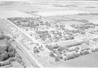
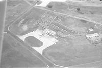
Title
-
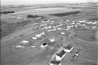
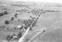
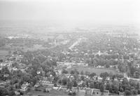
Round Hill
-
Description
-
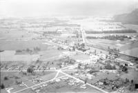
Aerial photograph of an agricultural community.
-
-
Title
-
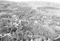
Aurora
-
Description
-
Aerial photograph of Aurora, a town in Southern Ontario.
-
Date
-
1958
-
-
Title
-
Aylmer
-
Description
-
Aerial photograph of a community 7 miles north of Aylmer, in Ontario.
-
Date
-
1958
-
-
Title
-
Ayr
-
Description
-
Aerial photograph of Ayr, a community within the Township of North Dumfries, in Southwestern Ontario.
-
Date
-
1958
-
-
Title
-
Atherley
-
Description
-
Aerial photograph of Atherley, a community in Southern Ontario.
-
Date
-
1958
-
-
Title
-
Atlee
-
Description
-
Aerial photograph of Atlee, a locality in Southern Alberta.
-
Date
-
1957
-
-
Title
-
Atherley
-
Description
-
Aerial photograph of Atherley, a community in Southern Ontario.
-
Date
-
1958
-
-
Title
-
Aurora
-
Description
-
Aerial photograph of Aurora, a town in Southern Ontario.
-
Date
-
1958
-
-
Title
-
Aylmer
-
Description
-
Aerial photograph of Aylmer, a town in Southern Ontario.
-
Date
-
1958
-
-
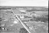
Title
-
Badger
-
Description
-
Aerial photograph of Badger, a hamlet in southeast Manitoba.
-
Date
-
1957
-
-
Title
-
Atmore
-
Description
-
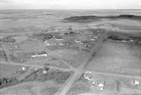
Aerial photograph of Atmore, a hamlet in Northern Alberta.
-
-
Title
-
Aylmer
-
Description
-
Aerial photograph of a community 7 miles north of Aylmer, in Ontario.
-
Date
-
1958
-
-
Title
-
Ayr
-
Description
-
Aerial photograph of Ayr, a community within the Township of North Dumfries, in Southwestern Ontario.
-
Date
-
1958
-
-
Title
-
Avon
-
Description
-
Aerial photograph of Avon, Ontario.
-
Date
-
1958
-
-
Title
-
Aylmer
-
Description
-
Aerial photograph of Aylmer, a town in Southern Ontario.
-
Date
-
1958
-
-
Title
-
Aylmer
-
Description
-
Aerial photograph of Aylmer, a town in Southern Ontario.
-
Date
-
1958
-
-
Title
-
Bala
-
Description
-
Aerial photograph of Bala, a rural community in Ontario.
-
Date
-
1958
-
-
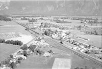
Title
-
Agassiz
-
Description
-
Aerial photograph of a small community in the Eastern Fraser Valley region of British Columbia.
-
Date
-
1958
-
-
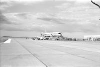
Title
-
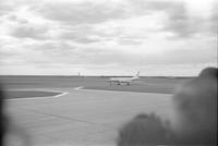
airshow
-
Description
-
Photograph of a Russian TU-104 in an airshow.
-
-
Title
-
airshow
-
Description
-
Aerial photograph of an airshow with a Russian TU-104.
-
-
Title
-
Alix
-
Description
-
Aerial photograph of Alix, a village in Central Alberta.
-
-
Title
-
Alix
-
Description
-
Aerial photograph of Alix, a village in Central Alberta.
-
-
Title
-
Agassiz
-
Description
-
Aerial photograph of a small community in the Eastern Fraser Valley region of British Columbia.
-
Date
-
1957
-
-
Title
-
airshow
-
Description
-
Photograph of a Russian TU-104 in an airshow.
-
-
Title
-
Alcomdale
-
Description
-
Aerial photograph of Alcomdale, a hamlet in Central Alberta.
-
Date
-
1957-07
-
-
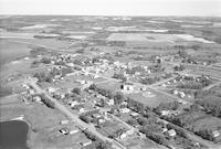
Title
-
Alexander
-
Description
-
Aerial photograph of Alexander, a community in western Manitoba.
-
Date
-
1957
Pages


