Error message
Warning: count(): Parameter must be an array or an object that implements Countable in theme_pager_link() (line 637 of /opt/rh/httpd24/root/var/www/html/drupal/web/includes/pager.inc).
Search results
Pages
-
-
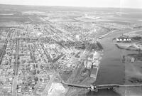
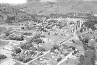
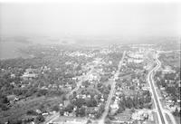
Title
-
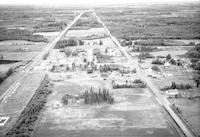
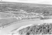
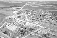
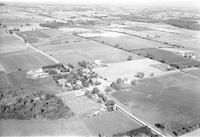
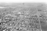
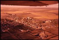
Flatbush
-
Description
-
Aerial photograph of Flatbush, a hamlet in Northern Alberta.
-
Date
-
1957-07
-
-
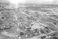
Title
-
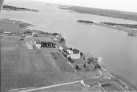
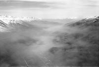
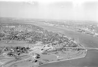
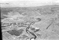
Fort Alexander?
-
Description
-
Aerial photograph of a community in western Manitoba. A river is visible in the background.
-
Date
-
1957
-
-
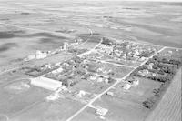
Title
-
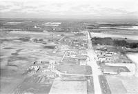
Foam Lake
-
Description
-
Aerial photograph of Foam Lake, a town in eastern Saskatchewan.
-
Date
-
1961
-
-
Title
-
Forrest
-
Description
-
Aerial photograph of Forrest, a small hamlet in western Manitoba.
-
Date
-
1957
-
-
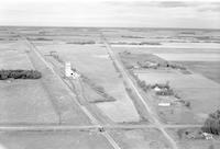
Title
-
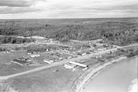
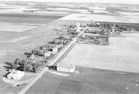
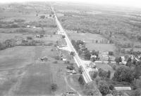
Fort Assiniboine
-
Description
-
Aerial photograph of Fort Assiniboine, a hamlet in northwest Alberta.
-
Date
-
1957-07
-
-
Title
-
Fort Assiniboine
-
Description
-
Aerial photograph of Fort Assiniboine, a hamlet in northwest Alberta.
-
Date
-
1957-07
-
-
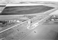
Title
-
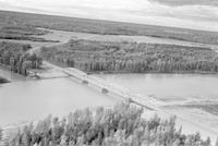
Fort Assiniboine
-
Description
-
Aerial photograph of a bridge in Fort Assiniboine, Alberta.
-
Date
-
1957-07
-
-
Title
-
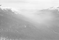
forest fire
-
Description
-
Aerial photograph of a forest fire south of Valemount, Britsh Columbia.
-
Date
-
1958
-
-
Title
-
forest fire
-
Description
-
Aerial photograph of a forest fire south of Valemount, Britsh Columbia.
-
Date
-
1958
-
-
Title
-
Fort Langley
-
Description
-
Aerial photograph of Fort Langley, a village in the Lower Mainland of British Columbia.
-
Date
-
1958
-
-
Title
-
Fort Langley
-
Description
-
Aerial photograph of Fort Langley, a village in the Lower Mainland of British Columbia.
-
Date
-
1957
-
-
Title
-
Fort Erie
-
Description
-
Aerial photograph of Fort Erie, a town in the Niagara Region of Ontario.
-
Date
-
1958
-
-
Title
-
Fort Erie
-
Description
-
Aerial photograph of Fort Erie, a town in the Niagara Region of Ontario.
-
Date
-
1958
-
-
Title
-
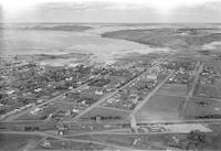
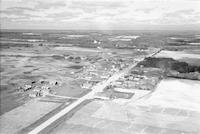
Fort Qu'Appelle
-
Description
-
Aerial photograph of Fort Qu'Appelle, a town in southeast Saskatchewan.
-
Date
-
1958
-
-
Title
-
Fort Battleford
-
Description
-
Aerial photograph of Fort Battleford, Saskatchewan.
-
-
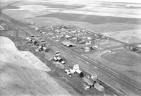
Title
-
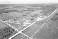
Foxwarren
-
Description
-
Aerial photograph of Foxwarren, a community in western Manitoba.
-
Date
-
1957
-
-
Title
-
Foxwarren
-
Description
-
Aerial photograph of Foxwarren, a community in western Manitoba.
-
Date
-
1957
-
-
Title
-
Franklin
-
Description
-
Aerial photograph of Franklin, a community in western Manitoba.
-
Date
-
1957
-
-
Title
-
Fort Qu'Appelle
-
Description
-
Aerial photograph of Fort Qu'Appelle, a town in southeast Saskatchewan. A lake is visible in the background.
-
Date
-
1958
-
-
Title
-
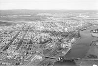
Fort William
-
Description
-
Aerial photograph of Fort William
-
Date
-
1958
-
-
Title
-
Fort William
-
Description
-
Aerial photograph of Fort William
-
Date
-
1958
-
-
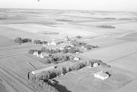
Title
-
Gordon
-
Description
-
Aerial photograph of Gordon, a community in the Interlake Region of Manitoba. The shadow of an airplane can be seen in the foreground.
-
Date
-
1957
-
-
Title
-
Golden Stream
-
Description
-
Aerial photograph of Golden Stream, a community in central Manitoba.
-
Date
-
1957
-
-
Title
-
Goodlands
-
Description
-
Aerial photograph of Goodlands, a community in western Manitoba.
-
Date
-
1957
-
-
Title
-
Goldstone
-
Description
-
Aerial photograph of Goldstone, a community in Mappleton, Ontario.
-
Date
-
1958
-
-
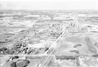
Title
-
Goodsoil
-
Description
-
Aerial photograph of Goodsoil, a village in western Saskatchewan.
-
Date
-
1956
-
-
Title
-
Goodsoil
-
Description
-
Aerial photograph of Goodsoil, a village in western Saskatchewan.
-
Date
-
1956
-
-
Title
-
Grahamdale
-
Description
-
Aerial photograph of Grahamdale, a community in the Interlake Region of Manitoba.
-
Date
-
1957
-
-
Title
-
Gobles
-
Description
-
Aerial photograph of a community in Ontario.
-
Date
-
1958
-
-
Title
-
Goward?
-
Description
-
Aerial photograph of a community in Ontario containing a body of water.
-
Date
-
1958
-
-
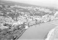
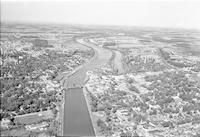
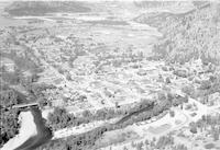
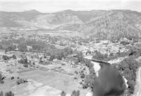
Title
-
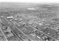
Grand Forks
-
Description
-
Aerial photograph of Grand Forks, a city in the West Kootenay Region on British Columbia.
-
Date
-
1957
-
-
Title
-
Grand Forks
-
Description
-
Aerial photograph of Grand Forks, a city in the West Kootenay Region on British Columbia.
-
Date
-
1957
-
-
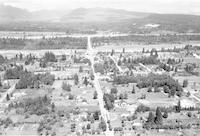
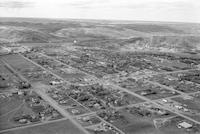
Title
-
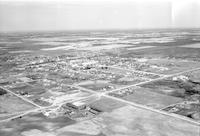
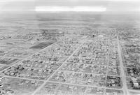
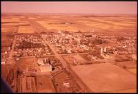
Grande Prairie
-
Description
-
Aerial photograph of Grande Prairie, a city in Northern Alberta.
-
Date
-
1956
-
-
Title
-
Grande Prairie
-
Description
-
Aerial photograph of Grande Prairie, a city in Northern Alberta.
-
Date
-
1956
-
-
Title
-
Grande Prairie
-
Description
-
Aerial photograph of Grande Prairie, a city in Northern Alberta.
-
Date
-
1956
-
-
Title
-
Grand Forks
-
Description
-
Aerial photograph of Grand Forks, a city in the West Kootenay Region on British Columbia.
-
Date
-
1957
-
-
Title
-
Grand Forks
-
Description
-
Aerial photograph of Grand Forks, a city in the West Kootenay Region on British Columbia.
-
Date
-
1957
-
-
Title
-
Grand Forks
-
Description
-
Aerial photograph of Grand Forks, a city in the West Kootenay Region on British Columbia.
-
Date
-
1958
-
-
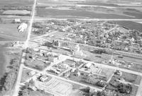
Title
-
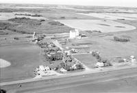
Gray
-
Description
-
Aerial photograph of Gray, a hamlet in southern Saskatchewan surrounded by farmland.
-
Date
-
1958
-
-
Title
-
Grayson
-
Description
-
Aerial photograph of Grayson, a village in southeast Saskatchewan.
-
Date
-
1958
-
-
Title
-
Gravelbourg
-
Description
-
Aerial photograph of Gravelbourg, a town in central Saskatchewan. A portion of the airplane's wing is visible in the upper part of the image.
-
Date
-
1958
-
-
Title
-
Gravelbourg
-
Description
-
Aerial photograph of Gravelbourg, a town in central Saskatchewan.
-
Date
-
1958
-
-
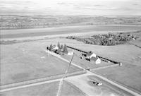
Title
-
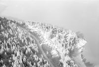
Gray Creek
-
Description
-
Aerial photograph of Gray Creek, British Columbia.
-
Date
-
1957
-
-
Title
-
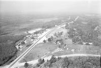
Gravenhurst
-
Description
-
Aerial photograph of 2 miles south of Gravenhurst, Ontario.
-
Date
-
1958
-
-
Title
-
Gravenhurst
-
Description
-
Aerial photograph of Gravenhurst, a town in Ontario.
-
Date
-
1958
-

-
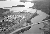
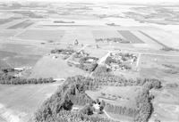
Title
-
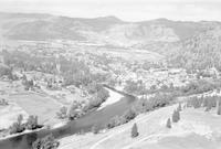
Great Falls
-
Description
-
Aerial photograph of Great Falls, a community in eastern Manitoba along the Winniped River. The Great Falls Generating Station is visible in the middle ground.
-
Date
-
1957
-
-
Title
-
Grayson
-
Description
-
Aerial photograph of Grayson, a village in southeast Saskatchewan.
-
Date
-
1958
-
-
Title
-
Graysville
-
Description
-
Aerial photograph of Graysville, a community in central Manitoba.
-
Date
-
1957
-
-
Title
-
Greenway
-
Description
-
Aerial photograph of Greenway, a village in south central Manitoba.
-
Date
-
1957
-
-
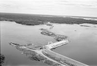
Title
-
Great Falls
-
Description
-
Aerial photograph of the Great Falls Dam in eastern Manitoba.
-
Date
-
1957
Pages


