Error message
Warning: count(): Parameter must be an array or an object that implements Countable in theme_pager_link() (line 637 of /opt/rh/httpd24/root/var/www/html/drupal/web/includes/pager.inc).
Search results
Pages
-
-
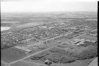
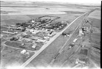
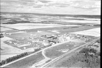
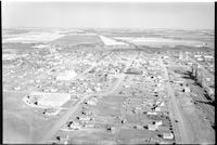
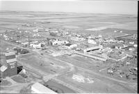
Title
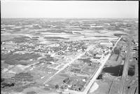
-
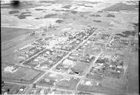
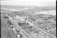
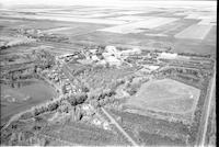
Melfort
-
Description
-
Aerial photograph of a large town with an expanse of farm land in the distance. The school is the dominant feature.
-
Date
-
, 1955
-
-
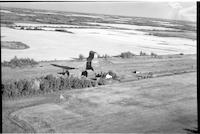
Title
-
Golburn
-
Description
-
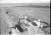
Aerial photograph of a grain elevator with railway tracks with agricultural land surrounding it.
-
Date
-
, 1956
-

-
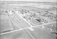
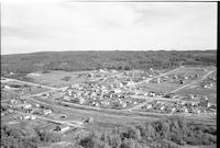
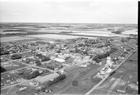
Title
-
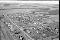
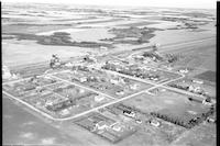
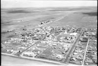
Outlook
-
Description
-
Aerial photograph of a small town next to the South Saskatchewan River. An expanse of farmland is visible in the background.
-
-
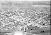
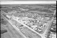
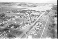
Title
-
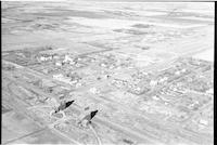
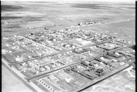
North Battleford
-
Description
-
Aerial photograph of a small town with streets, hotel, vehicles, schools and a water tower. A train bridge is also visible.
-
-
Title
-
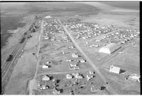
Ethelton
-
Description
-
Aerial photograph of a small town with houses, a church, grain elevators with an expanse of agricultural land in background.
-
-
Title
-
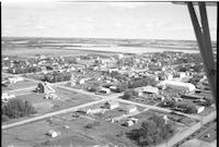
Langham
-
Description
-
Aerial photograph of a small town with a church, school, grain elevators, railway tracks, access roads, false fronts and agricultural land visible in background.
-
Date
-
, 1955
-
-
Title
-
Limerick
-
Description
-
Aerial photograph of a small town with churches, dwellings, grain elevators, railway tracks and a school. Agricultural land is visible in the background.
-
Date
-
, 1955
-
-
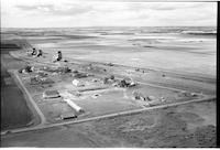
Title
-
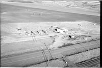
North Battleford
-
Description
-
Aerial photograph of a B.A. service station, a few trailers, a highway and cattle and agricultural land in the background.
-
Date
-
, 1955
-
-
Title
-
Froude
-
Description
-
Aerial photograph of a hamlet with a church and a school, grain elevators with agricultural land visible in background.
-

-
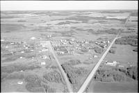
Title
-
Outlook
-
Description
-
Aerial photograph of a small town. An expanse of farmland is visible in the background.
-
-
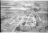
Title
-
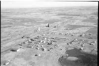
Luseland
-
Description
-
Aerial photograph of a small town with an expanse of farm land in the distance. Main Street and grain elevators are the dominant features.
-
-
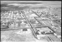
Title
-
Osler
-
Description
-
Aerial photograph of a small town. An expanse of farmland is visible in the background.
-
-
Title
-
Forget
-
Description
-
Aerial photograph of a village surrounded by farm land. A church, rectory, and other religious buildings are visible, as is the main street, the railroad, and grain elevators.
-
Date
-
, 1955
-
![Willowbunch [Willow Bunch]](/islandora/object/mcphail%3A1296/datastream/TN/view)
-
Title
-
Willowbunch [Willow Bunch]
-
Description
-
Aerial photograph of a small community with gentle, rolling hills behind it.
-
Date
-
, 1955
-
-
Title
-
Sturgis
-
Description
-
Aerial photograph of town surrounded by farmland dotted with trees.
-
Date
-
, 1956
-
-
Title
-
Weyburn
-
Description
-
Aerial photograph of a mental hospital surrounded by clusters of trees.
-
Date
-
, 1955
-
-
Title
-
Torquay
-
Description
-
Aerial photograph of an agricultural village with a vast expanse of farm land in he background.
-
-
Title
-
Torquay
-
Description
-
Aerial photograph of an agricultural village surrounded by farmland.
-
-
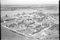
Title
-
Shellbrook
-
Description
-
Aerial photograph of a well-sized rural community. An expanse of farmland is visible in the background.
-
-
Title
-
Springwater
-
Description
-
Aerial photograph of an agricultural hamlet on the Prairies.
-

-
Title
-
Speers
-
Description
-
Aerial photograph of a village surrounded by an expanse of farmland.
-

-
Title
-
Stoughton
-
Description
-
Aerial photograph of a small agricultural town. An expanse of farmland is visible in the background.
-
Date
-
, 1955
-
-
Title
-
Veregin
-
Description
-
Aerial photograph of a village surrounded by farmland.
-
Date
-
, 1956
-
-
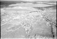
Title
-
Paradise Hill
-
Description
-
Aerial photograph of the village of Paradise Hill, showing surrounding forested rolling hills, farmland and a lake.
-
-
Title
-
Shellbrook
-
Description
-
Aerial photograph of a well-sized rural community. An expanse of farmland is visible in the background.
-
-
Title
-
Tway
-
Description
-
Aerial photograph of a hamlet surrounded by farm land. A school, church, and railroad are easily visible.
-
-
Title
-
Paradise Hill
-
Description
-
Aerial photograph of the village of Paradise Hill, showing surrounding forested rolling hills.
-
-
Title
-
Sheho
-
Description
-
Aerial photograph of a well-sized agricultural community.
-
-
Title
-
Resource
-
Description
-
Aerial photograph of a community dominated by farmland.
-
-
Title
-
Vantage
-
Description
-
Aerial photograph of hamlet with a vast expanse of farmland in the background.
-
Date
-
, 1956
-

-
Title
-
Star City
-
Description
-
Aerial photograph of a large town in Saskatchewan.
-
Date
-
, 1955
-
-
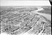
Title
-
Prince Albert
-
Description
-
Aerial photograph of a city with a river running through it.
-
-
Title
-
Raymore
-
Description
-
Aerial photograph of a town with farmland and clusters of trees in the background.
-
-
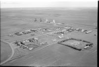
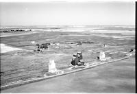
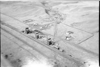
Title
-
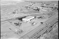
Esso Service Station
-
Description
-
Aerial photograph of the Esso Service Station in Swift Current, Saskatchewan.
-
-
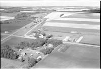
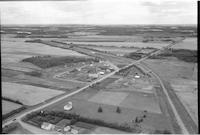
Title
-
Tallman
-
Description
-
Aerial photograph of two grain elevators and some houses in the middle of the Prairies.
-
-
Title
-
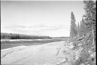
Stony Rapids
-
Description
-
Aerial photograph of the landscape near Stony Rapids, a northern hamlet in Saskatchewan.
-
-
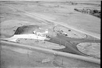
Title
-
North Star Oil: service station
-
Description
-
Aerial photograph of North Star Oil service station. Several vehicles are parked nearby.
-
-
Title
-
Stoughton
-
Description
-
Aerial photograph of a small town surrounded by farmland.
-
Date
-
, 1955
-
-
Title
-
Tate
-
Description
-
Aerial photograph of a rural hamlet surrounded by farmland.
-
-
Title
-
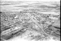
Tisdale
-
Description
-
Aerial photograph of a small town and agricultural business center. An expanse of farmland is visible in the background.
-
-
Title
-
Torquay
-
Description
-
Aerial photograph of a village with farmland in the background.
-

-
Title
-
Shelbrook
-
Description
-
Aerial photograph of a well-sized rural community. An expanse of farmland is visible in the background.
-
-
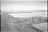
Title
-
Superb
-
Description
-
Aerial photograph of a agricultural hamlet with an expanse of farmland in the background.
-
-
Title
-
Smiley
-
Description
-
Aerial photograph of an agricultural community surrounded by farmland and tree stands.
-
-
Title
-
Shellbrook
-
Description
-
Aerial photograph of a rural community.
-
-
Title
-
Togo
-
Description
-
Aerial photograph of an agricultural village with an expanse of farmland in the background.
-
Date
-
, 1956
-
-
Title
-
Tarnopol
-
Description
-
Aerial photograph of a hamlet. It is now a ghost town.
-
-
Title
-
Tichfield
-
Description
-
Aerial photograph of an unincorporated hamlet nestled in a number of a small hills.
-
Date
-
, 1955
-
-
Title
-
Spalding
-
Description
-
Aerial photograph of an agricultural village surrounded by an expanse of farmland.
-
-
Title
-
Spuce Lake
-
Description
-
Aerial photograph of an agricultural hamlet surrounded by an expanse of farmland.
Pages


