Error message
Warning: count(): Parameter must be an array or an object that implements Countable in theme_pager_link() (line 637 of /opt/rh/httpd24/root/var/www/html/drupal/web/includes/pager.inc).
Search results
Pages
-
-
Title
-
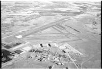
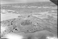
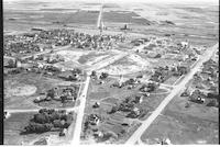
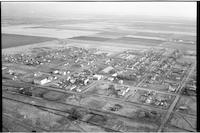
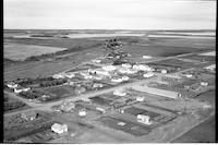
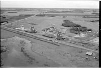
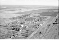
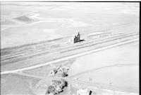
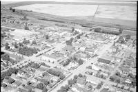
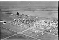
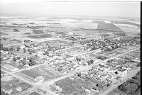
North Battleford Airport
-
Description
-
Aerial photograph of the airport at North Battleford. An expanse of farmland is visible in the background.
-
Date
-
, 1959
-
-
Title
-
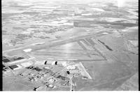
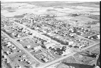
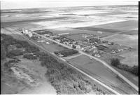
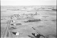
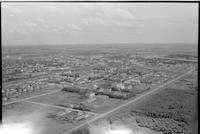
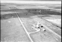
North Battleford Airport
-
Description
-
Aerial photograph of the airport at North Battleford. An expanse of farmland is visible in the background.
-
Date
-
, 1959
-

-
Title
-
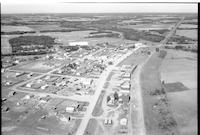
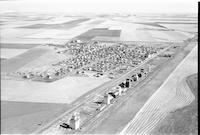
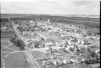
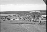
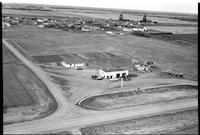
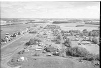
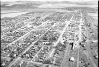
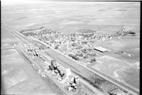
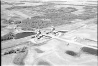
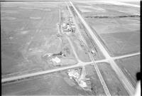
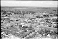
Outlook
-
Description
-
Aerial photograph of small town next to the South Saskatchewan River. An expanse of farmland is visible in the background.
-

-
Title
-
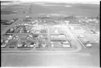
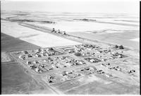
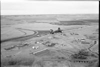
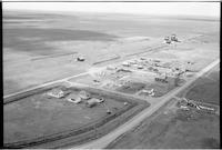
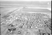
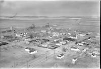
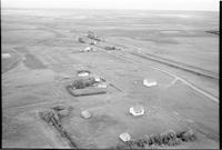
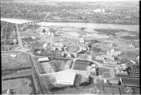
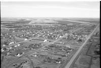
North Battleford: Mental Hospital
-
Description
-
Aerial photograph of the Mental Hospital near North Battleford. The buildings are surrounded by planted trees, then farm land.
-

-
Title
-
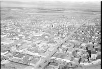
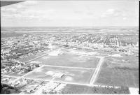
Nipawin
-
Description
-
Aerial photograph of a town surrounded by forests and farm land.
-
-
Title
-
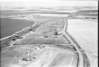
Glaslyn
-
Description
-
Aerial photograph of a village surrounded by farm land. The main street, railroad, grain elevators, and a school [?] are visible. Dart's Store is visible at the far end of the town, near the junction of three roads.
-
Date
-
, 1956
-
-
Title
-
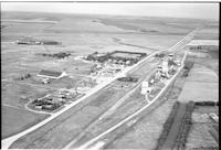
Plato
-
Description
-
Aerial photograph of a small agricultural town. An expanse of farmland is visible in the background.
-
Date
-
, 1956
-
-
Title
-
Gibbs
-
Description
-
Aerial photograph of a small hamlet with farmhouses and a grain elevator. Agricultural land in background.
-
-
Title
-
Prelate
-
Description
-
Aerial photograph of an agricultural village. An expanse of farmland is visible in the background.
-
Date
-
, 1955
-
-
Title
-
Portreeve
-
Description
-
Aerial photograph of an agricultural village. An expanse of farmland is visible in the background.
-
Date
-
, 1955
-
-
Title
-
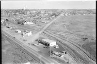
North Battleford
-
Description
-
Aerial photograph of North Battleford. Manegre's garage is visible in the foreground.
-
-
Title
-
Nokomis
-
Description
-
Aerial photograph of a small town. An expanse of farmland is visible in the background.
-
-
Title
-
Nipawin
-
Description
-
Aerial photograph of a town surrounded by forests and farm land.
-
-
Title
-
Govan
-
Description
-
Aerial photograph of a town surrounded by farm land. The main street is plainly visible.
-
Date
-
, 1956
-
-
Title
-
Handsworth
-
Description
-
Aerial photograph of a hamlet, which is now a ghost town.
-
-
Title
-
Outlook
-
Description
-
Aerial photograph of a small town. An expanse of farmland is visible int he background.
-
Date
-
, 1955
-
-
Title
-
Glaslyn
-
Description
-
Aerial photograph of a village surrounded by farm land and forests. The view looks across the railroad to the town.
-
Date
-
, 1956
-
-
Title
-
Fairmount
-
Description
-
Aerial photograph of a hamlet with grain elevators, farmhouses and agricultural land visible in the background.a
-
-
Title
-
Keeler
-
Description
-
Aerial photograph of a village along a highway running to the horizon.
-
-
Title
-
Pilger
-
Description
-
Aerial photograph of a small village. An expanse of farmland is visible in the background.
-
-
Title
-
Lac Vert
-
Description
-
Aerial photograph of a community.
-
-
Title
-
Paynton: Service Station
-
Description
-
Aerial photograph of an agricultural village in Saskatchewan. A "TEXACO" service station is visible in the foreground.
-
Date
-
, 1956
-

-
Title
-
Onion Lake
-
Description
-
Aerial photograph of a small community. An expanse of woodland and some farmland is visible in the background.
-
Date
-
, 1956
-
-
Title
-
Outram
-
Description
-
Aerial photograph of a hamlet. An expanse of farmland is visible in the background.
-
Date
-
, 1956
-
-
Title
-
Orcadia
-
Description
-
Aerial photograph of a small agricultural community. An expanse of farmland is visible in the background.
-
-
Title
-
Parkside
-
Description
-
Aerial photograph of an agricultural village. An expanse of farmland is visible in the background.
-
-
Title
-
Outlook
-
Description
-
Aerial photograph of a small town. An expanse of farmland is visible in the background.
-

-
Title
-
Naicam
-
Description
-
Aerial photograph of a small town. An expanse of farmland is visible in the background.
-
-
Title
-
North Battleford
-
Description
-
Aerial photograph of a small city.
-
-
Title
-
Forget
-
Description
-
Aerial photograph of a village surrounded by farm land. A church, rectory, and other religious buildings are visible, as is the main street, the railroad, and grain elevators.
-
Date
-
, 1955
-
-
Title
-
Fusilier
-
Description
-
Aerial photograph of an unincorporated hamlet with a grain elevator, a church and houses with agricultural land in background.
-
-
Title
-
Melfort
-
Description
-
Aerial photograph of a large town with an expanse of farm land in the distance.
-
Date
-
, 1955
-
-
Title
-
Plato
-
Description
-
Aerial photograph of a small agricultural town. An expanse of farmland is visible in the background.
-
Date
-
, 1956
-
-
Title
-
Diana
-
Description
-
Aerial photograph of a community surrounded by farmland.
-
Date
-
, 1956
-
-
Title
-
Wilcox
-
Description
-
Aerial photograph of small agricultural village surrounded by expansive farmland.
-
Date
-
, 1956
-
-
Title
-
Yorkton
-
Description
-
Aerial photograph of a city surrounded by agricultural farmland.
-
Date
-
, 1956
-

-
Title
-
Xena
-
Description
-
Aerial photograph of an unincorporated area near numerous clusters of trees.
-
-
Title
-
Ettington
-
Description
-
Aerial photograph of a hamlet surrounded by farmland.
-
Date
-
, 1956
-
-
Title
-
Wilkie
-
Description
-
Aerial photograph of downtown area of small agricultural town surrounded by expansive farmland.
-
-
Title
-
University of Sask
-
Description
-
Aerial photograph of the University of Saskatchewan.
-
-
Title
-
Edmore
-
Description
-
Aerial photograph of an unincorporated area surrounded by clusters of trees with some small sloughs nearby.
-
Date
-
, 1956
-
-
Title
-
Yorkton
-
Description
-
Aerial photograph of a city with trees and water to the right.
-
-
Title
-
White Bear
-
Description
-
Aerial photograph of a hamlet surrounded by farmland.
-
Date
-
, 1956
-

-
Title
-
Mantario
-
Description
-
Aerial photograph of a hamlet.
-
Date
-
, 1956
-
![Beanfield [Beaufield]](/islandora/object/mcphail%3A1581/datastream/TN/view)
-
Title
-
Beanfield [Beaufield]
-
Description
-
Aerial photograph of a hamlet surrounded by farmland.
-
Date
-
, 1956
-
-
Title
-
Moreland
-
Description
-
Aerial photograph of a community; farmland dominates the landscape.
-
Date
-
, 1956
-
-
Title
-
Stelcam
-
Description
-
Aerial photograph of an unincorporated area.
-
Date
-
, 1956
-
-
Title
-
Watrous
-
Description
-
Aerial photograph of small town with an expanse of farmland in the background.
-
-
Title
-
Watrous
-
Description
-
Aerial photograph of small agricultural town with farmland in the background.
-
-
Title
-
Yorkton
-
Description
-
Aerial photograph of a city surrounded by agricultural farmland.
Pages


