Error message
Warning: count(): Parameter must be an array or an object that implements Countable in theme_pager_link() (line 637 of /opt/rh/httpd24/root/var/www/html/drupal/web/includes/pager.inc).
Search results
Pages
-
-
Title
-
Revenue
-
Description
-
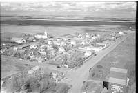
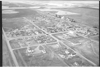
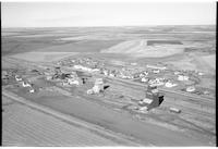
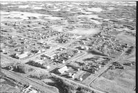
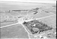
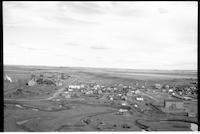
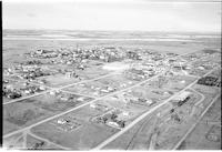
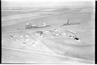
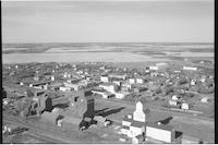
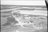
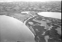
Aerial photograph of a hamlet with an expanse of farmland in the background.
-
-
Title
-
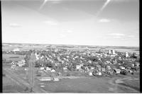
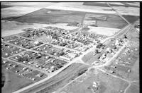
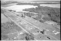
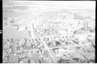
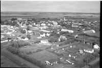
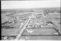
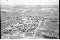
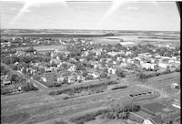
Rosthern
-
Description
-
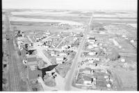
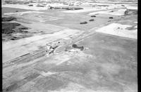
Aerial photograph of a small town. An expanse of farmland is visible in the background.
-
-
Title
-
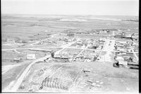
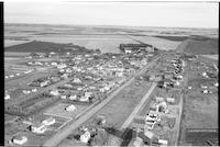
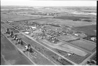
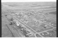
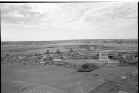
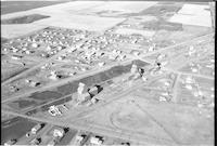
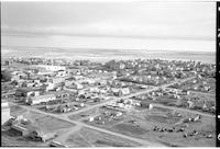
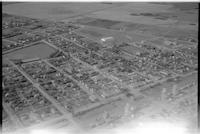
Herschel
-
Description
-
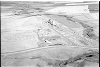
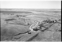
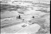
Aerial photograph of a small town containing two grain elevators. An expanse of farmland is visible in the background, and a large building under construction is visible in the foreground.
-
Date
-
, 1956
-
-
Title
-
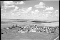
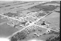
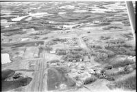
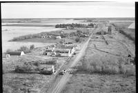
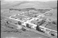
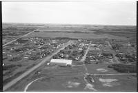
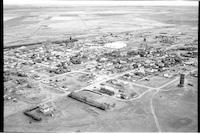
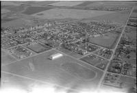
Macrorie
-
Description
-
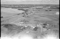
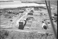
Aerial photograph of a small community. An expanse of farmland is visible in the background.
-
Date
-
, 1955
-
-
Title
-
Frontier
-
Description
-
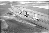
Aerial photograph of a small town containing several grain elevators. An expanse of farmland is visible in the background.
-
Date
-
, 1956
-
-
Title
-
Hague
-
Description
-
Aerial photograph of a small town containing several grain elevators. A stretch of farmland is visible in the background.
-
Date
-
, 1954
-
-
Title
-
Lake Lenore
-
Description
-
Aerial photograph of a small town. An expanse of farmland is visible in the background.
-
-
Title
-
Makwa
-
Description
-
Aerial photograph of a small community. An expanse of wooded prairie and farmland is visible in the background.
-
-
Title
-
Lajord
-
Description
-
Aerial photograph of a small town. An expanse of farmland is visible in the background.
-
-
Title
-
Kilwinning
-
Description
-
Aerial photograph of a small hamlet containing a grain elevator, which is surrounded by farmland.
-
-
Title
-
Marcelin
-
Description
-
Aerial photograph of a small town. An expanse of farmland is visible in the background.
-
-
Title
-
Baring
-
Description
-
Aerial photograph of a small hamlet with a grain elevator and farms. Cropland is visible in the background.
-
Date
-
, 1955
-
-
Title
-
Earl Grey
-
Description
-
Aerial photograph of a village surrounded by farmland.
-
Date
-
, 1955
-
-
Title
-
Cochin
-
Description
-
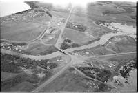
Aerial photograph of a resort village. Jackfish Lake is visible. A double-arch bridge (Cochin Bridge; originally Jackfish Narrows Bridge) spans Lehman Creek.
-
-
Title
-
Burnham
-
Description
-
Aerial photograph of a hamlet with 2 grain elevators, a farm house, roads and an expanse of agricultural land in the background.
-
-
Title
-
Cochin
-
Description
-
Aerial photograph of a resort village. Jackfish Lake Narrows Bridge spans Lehman Creek, a channel that connects Jackfish Lake and Murray Lake.
-
-
Title
-
Cochin
-
Description
-
Aerial photograph of a resort village. A gas station and store is in the middle of the image. In the distance is Jackfish Lake or Murray Lake.
-
-
Title
-
Prongua
-
Description
-
Aerial photograph of an agricultural community.
-
-
Title
-
Girvin
-
Description
-
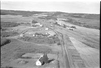
Aerial photograph of a small town containing several grain elevators. A set of train tracks goes by them to the left, a highway runs through the town to the right, and an expanse of farmland is visible in the background. A church building is also visible near the center of the town.
-
-
Title
-
Furness
-
Description
-
Aerial photograph of a small town containing several grain elevators. An expanse of farmland and lightly wooded prairie is visible in the background.
-
Date
-
, 1956
-
-
Title
-
Herschel
-
Description
-
Aerial photograph of a small town containing several grain elevators. An expanse of farmland is visible in the background.
-
-
Title
-
Kelvington
-
Description
-
Aerial photograph of a small town containing several grain elevators. A stretch of farmland is visible in the background.
-
Date
-
, 1955
-
-
Title
-
Frontier
-
Description
-
Aerial photograph of a small town containing several grain elevators. An expanse of farmland is visible in the background.
-
Date
-
, 1956
-
-
Title
-
Foxford
-
Description
-
Aerial photograph of a small town containing a grain elevator. An expanse of farmland is visible in the background.
-
-
Title
-
Kerrobert
-
Description
-
Aerial photographs of a small town. An expanse of farmland is visible in the background.
-
-
Title
-
Grasswood
-
Description
-
Aerial photograph of a grain elevator surrounded by farmland.
-
-
Title
-
Crichton
-
Description
-
Aerial photograph of a hamlet. Grain elevators and railway tracks are visible in foreground, with an expanse of farmland in the background.
-

-
Title
-
St. Louis
-
Description
-
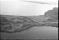
Aerial photograph of an agricultural village next to the South Saskatchewan River. An expanse of wooded prairie and farmland is visible in the background. The St. Louis Bridge is visible crossing the South Saskatchewan River.
-
-
Title
-
Robinhood
-
Description
-
Aerial photograph of a hamlet. An expanse of farmland is visible in the background.
-
-
Title
-
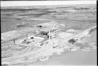
Sask Power plant
-
Description
-
Aerial photograph of the Sask Power plant alongside Spadina Crescent under construction. The power plant is known today as the Queen Elizabeth Power Station operated by SaskPower. The South Saskatchewan River is visible in the background.
-
-
Title
-
Cut Knife
-
Description
-
Aerial photograph of a small town with dwellings, churches, a lumberyard, store fronts and agricultural land in background.
-
-
Title
-
Prud'homme
-
Description
-
Aerial photograph of an agricultural village. A quonset under construction is visible in the lower left.
-

-
Title
-
Prud'homme
-
Description
-
Aerial photograph of an agricultural village.
-
-
Title
-
Richard
-
Description
-
Aerial photograph of a village. An expanse of farmland is visible in the background.
-
-
Title
-
Isham
-
Description
-
Aerial photograph of a small town containing three grain elevators. Two rows of railway cars are lined up next to the elevators, and an expanse of farmland is visible in the background.
-
Date
-
, 1956
-
-
Title
-
Mazenod
-
Description
-
Aerial photograph of a small town. An expanse of farmland is visible in the background.
-
Date
-
, 1956
-
-
Title
-
Laird
-
Description
-
Aerial photograph of a small town. An expanse of farmland in the background.
-
Date
-
, 1955
-
-
Title
-
Lanigan
-
Description
-
Aerial photograph of a small town. A body of water and an expanse of farmland is visible in the background.
-
-
Title
-
Kinistino
-
Description
-
Aerial photograph of a small town containing several grain elevators. A quonset is visible in the top right quarter of the image, and an expanse of farmland is visible in the background.
-
-
Title
-
Loreburn
-
Description
-
Aerial photograph of a small town. An expanse of farmland is visible in the background.
-
-
Title
-
Kerrobert
-
Description
-
Aerial photograph of a small town containing a grain elevator. An expanse of farmland is visible in the background.
-
-
Title
-
Kerrobert
-
Description
-
Aerial photograph of a small town with an expanse of farmland in the background.
-
-
Title
-
Robinhood
-
Description
-
Aerial photograph of a hamlet. An expanse of farmland is visible in the background.
-
-
Title
-
Adair
-
Description
-
Aerial photograph of a small town. A grain elevator, farmhouse, and railway tracks are visible with farmland in the background.
-
-
Title
-
Regina
-
Description
-
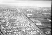
Aerial photograph of Regina. Rows and rows of residential houses are visible in a linear pattern. The Saskatchewan Legislative Building is visible with a view of Wascana Lake.
-
-
Title
-
Clemens
-
Description
-
Aerial photograph of a hamlet with grain elevators, farmhouses, railway tracks and agricultural land.
-
-
Title
-
Cochin
-
Description
-
Aerial photograph of a resort village. Jackfish Lake Narrows Bridge spans Lehman Creek, a channel that connects Jackfish Lake and Murray Lake.
-
-
Title
-
Rosthern
-
Description
-
Aerial photograph of a large town. An expanse of farmland is visible in the background.
-
-
Title
-
Rosthern
-
Description
-
Aerial photograph of a small town.
-
-
Title
-
Rosthern
-
Description
-
Aerial photograph of a small town.
Pages


