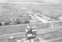
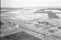
Error message
Warning: count(): Parameter must be an array or an object that implements Countable in theme_pager_link() (line 637 of /opt/rh/httpd24/root/var/www/html/drupal/web/includes/pager.inc).
Search results
Pages
-
-
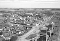
Title
-
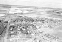
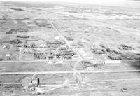
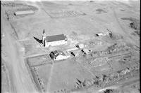
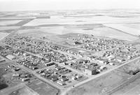
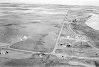
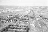
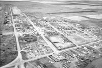
Benson
-
Description
-
Aerial photograph of a hamlet with a church, grain elevators, railway, and a corral by the railway. Agricultural land is visible in background.
-
Date
-
, 1955
-

-
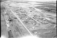
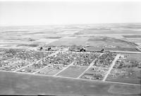
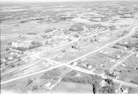
Title
-
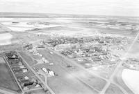
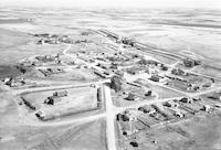
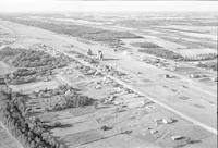
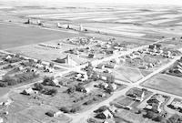
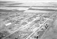
Ardath
-
Description
-
Aerial photograph of a small town with an expanse of farmland visible surrounding it. A large brick building is visible in background across highway.
-
-
Title
-
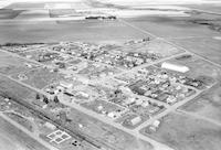
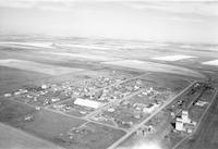
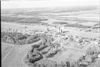
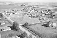
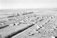
Sanctuary
-
Description
-
Aerial photograph of a hamlet surrounded by an expanse of farmland. One of the grain elevator's reads: "Ogilvie Oats" on one side, and "Ogilvie Flour."
-
Date
-
, 1956
-
-
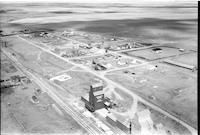
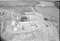
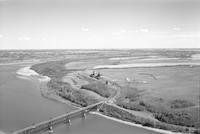
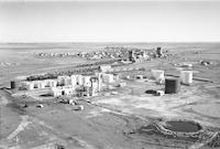
Title
-
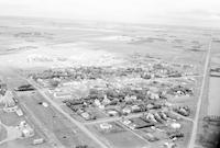
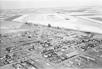
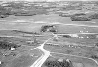
Sask Power plant
-
Description
-
Aerial photograph of the Sask Power plant alongside Spadina Crescent under construction. The power plant is known today as the Queen Elizabeth Power Station owned and operated by SaskPower. The South Saskatchewan River and the Grand Trunk train bridge is visible in the background.
-
-
Title
-
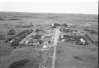
Bayard
-
Description
-
Aerial photograph of Bayard, a hamlet in Central Saskatchewan.
-
Date
-
1957
-
-
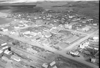
Title
-
Balcarres
-
Description
-
Aerial photograph of Balcarres, a town in southern Saskatchewan.
-
Date
-
1958
-
-
Title
-
Balcarres
-
Description
-
Aerial photograph of Balcarres, a town in southern Saskatchewan.
-
Date
-
1958
-
-
Title
-
Avonlea
-
Description
-
Aerial photograph of Avonlea, a village in south central Saskatchewan.
-
Date
-
1957
-
-
Title
-
Balcarres
-
Description
-
Aerial photograph of Balcarres, a town in southern Saskatchewan.
-
Date
-
1957
-

-
Title
-
Avonlea
-
Description
-
Aerial photograph of Avonlea, a village in south central Saskatchewan.
-
Date
-
1957
-
-
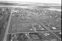
Title
-
Atwater
-
Description
-
Aerial photograph of Atwater, a village in eastern Saskatchewan.
-
Date
-
1957
-
-
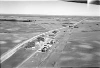
Title
-
Admiral
-
Description
-
Aerial photograph of Admiral, originally named Blairville, a former village in southwest Saskatchewan. An expanse of farmland is visible in the background.
-
-
Title
-
Alsask
-
Description
-
Aerial photograph of Alsask, an area in northeast Saskatchewan.
-
Date
-
1959
-
-
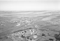
Title
-
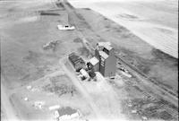
Guernsey
-
Description
-
Aerial photograph of Guernsey, a former village in Saskatchewan established in January 1908 and restructured as a hamlet in the Rural Municipality of Usborne in December 2005. A Saskatchewan Pool Elevator is visible on the left, bearing the number 230.
-
-
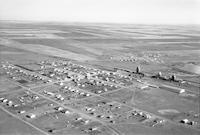
Title
-
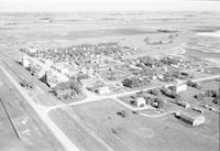
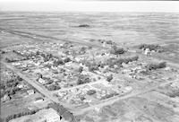
Hanley
-
Description
-
Aerial photograph of Hanley, a town in central Saskatchewan. A grain elevator is visible in the bottom left corner.
-
-
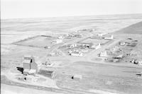
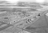
Title
-
Hoosier
-
Description
-
Aerial photograph of Hoosier, an unincorporated hamlet in western Saskatchewan, including the Hoosier United Church and the Hoosier School. A Saskatchewan Wheat Pool grain elevator is visible in bottom left corner along the railway. The hamlet is surrounded by extensive farmland.
-
Date
-
1956
-
-
Title
-
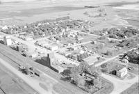
Hanley
-
Description
-
Aerial photograph of Hanley, a town in Saskatchewan. An expanse of farmland is visible in the background.
-
-
Title
-
Hanley
-
Description
-
Aerial photograph of Hanley, a town in central Saskatchewan. Several grain elevators are visible in the left. An expanse of farmland is visible in the background.
-
-
Title
-
Jackfish Lake
-
Description
-
Aerial photograph of a church in Jackfish, a hamlet in Saskatchewan. A cemetery is visible in the background.
-
-
Title
-
Arden
-
Description
-
Aerial photograph of Arden in Southwest Saskatchewan.
-
Date
-
1956
-
-
Title
-
Arden
-
Description
-
Aerial photograph of Arden, a town in Southwest Saskatchewan.
-
Date
-
1956
-
-
Title
-
Cabri
-
Description
-
Aerial photograph of Cabri, a town in southwest Saskatchewan. An expanse of farmland is visible in the background.
-
-
Title
-
Cabri
-
Description
-
Aerial photograph of Cabri, a town in southwest Saskatchewan. An expanse of farmland is visible in the background.
-
-
Title
-
Burrows
-
Description
-
Aerial photograph of Burrows, a community in south east Saskatchewan.
-
Date
-
1957
-

-
Title
-
Canwood
-
Description
-
Aerial photograph of Canwood, a village in central Saskatchewan.
-
Date
-
1959
-
-
Title
-
Canwood
-
Description
-
Aerial photograph of Canwood, a village in central Saskatchewan.
-
Date
-
1959
-
-
Title
-
Cadillac
-
Description
-
Aerial photograph of Cadillac, a village in southwest Saskatchewan. Several grain elevators and an expanse of farmland are visible in the background.
-
-
Title
-
Cadillac
-
Description
-
Aerial photograph of Cadillac, a village in southwest Saskatchewan. Several grain elevators and an expanse of farmland are visible in the background.
-
-
Title
-
Cardross
-
Description
-
Aerial photograph of Cardross, a hamlet in south central Saskatchewan.
-
Date
-
1957
-
-
Title
-
Cardross
-
Description
-
Aerial photograph of Cardross, a hamlet in south central Saskatchewan.
-
Date
-
1957
-
-
Title
-
Carievale
-
Description
-
Aerial photograph of Carievale, a village in southeast Saskatchewan.
-
Date
-
1956
-
-
Title
-
Carievale
-
Description
-
Aerial photograph of Carievale, a village in southeast Saskatchewan.
-
Date
-
1956
-
-
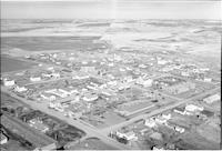
Title
-
Carnduff
-
Description
-
Aerial photograph of Carnduff, a town in southeast Saskatchewan.
-
Date
-
1961
-
-
Title
-
Cedoux
-
Description
-
Aerial photograph of Cedoux, a community in southeast Saskatchewan.
-
Date
-
1958
-
-
Title
-
Ceepee
-
Description
-
Aerial photograph of Ceepee, a community in central Saskatchewan.
-
Date
-
1959
-
-
Title
-
Cavalier
-
Description
-
Aerial photograph of Cavalier, a community in western Saskatchewan.
-
Date
-
1959
-
-
Title
-
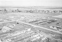
Chaplin
-
Description
-
Aerial photograph of Chaplin, a village in south central Saskatchewan.
-
-
Title
-
Chaplin
-
Description
-
Aerial photograph of Chaplin, a village in south central Saskatchewan.
-
-
Title
-
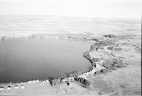
Clearwater Lake
-
Description
-
Aerial photograph of Clearwater Lake in southwest Saskatchewan.
-
Date
-
1959
-
-
Title
-
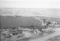
Clearwater Lake
-
Description
-
Aerial photograph of Clearwater Lake in southwest Saskatchewan.
-
Date
-
1959
-
-
Title
-
Climax
-
Description
-
Aerial photograph of Climax, a village in southwest Saskatchewan.
-
-
Title
-
Climax
-
Description
-
Aerial photograph of Climax, a village in southwest Saskatchewan.
-
Date
-
1956
-
-
Title
-
Coleville
-
Description
-
Aerial photograph of Coleville, a village in western Saskatchewan.
-
-
Title
-
Coleville
-
Description
-
Aerial photograph of Coleville, a village in western Saskatchewan.
-
-
Title
-
Coleville
-
Description
-
Aerial photograph of Coleville, a village in western Saskatchewan.
-
-
Title
-
Coleville
-
Description
-
Aerial photograph of Coleville, a village in western Saskatchewan.
-
Date
-
1959
-
-
Title
-
Coleville
-
Description
-
Aerial photograph of Coleville, a village in western Saskatchewan.
-
Date
-
1959
-
-
Title
-
Colfax
-
Description
-
Aerial photograph of Colfax, a community in southeast Saskatchewan.
-
Date
-
1958
-
-
Title
-
Choiceland
-
Description
-
Aerial photograph of Choiceland, a town in northeast Saskatchewan.
-
-
Title
-
Churchbridge
-
Description
-
Aerial photograph of Churchbridge, a town in southeast Saskatchewan.
Pages


