Error message
- Warning: count(): Parameter must be an array or an object that implements Countable in theme_pager_link() (line 637 of /opt/rh/httpd24/root/var/www/html/drupal/web/includes/pager.inc).
- Warning: count(): Parameter must be an array or an object that implements Countable in theme_pager_link() (line 637 of /opt/rh/httpd24/root/var/www/html/drupal/web/includes/pager.inc).
Search results
Pages
-
-
Title
-
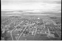
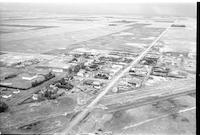
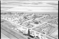
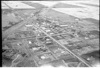
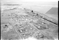
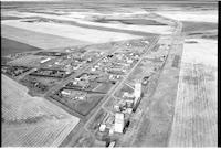
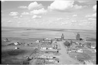
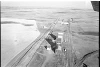
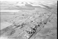
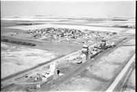
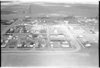
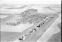
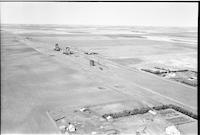
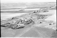
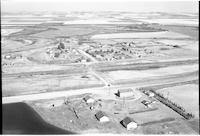
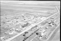
Gull Lake
-
Description
-
Aerial photograph of a small town. An expanse of farmland is visible in the background.
-
Date
-
, 1960
-
-
Title
-
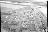
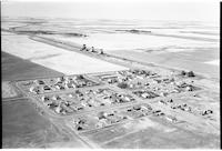
Elrose
-
Description
-
Aerial photograph of a small town containing two grain elevators. An expanse of farmland is visible in the background.
-
Date
-
, 1960
-
-
Title
-
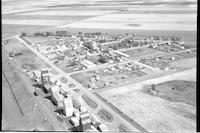
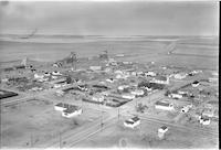
Hallonquist
-
Description
-
Aerial photograph of a hamlet containing several grain elevators. An expanse of farmland is visible in the background.
-
Date
-
, 1960
-
-
Title
-
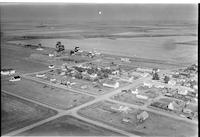
Leader
-
Description
-
Aerial photograph of a small town. An expanse of farmland is visible in the background.
-
Date
-
, 1955
-

-
Title
-
Blumenhof
-
Description
-
Aerial photograph of a hamlet with dwellings, railway tracks, grain elevators, and cropland visible in the background.
-
-
Title
-
Birsay
-
Description
-
Aerial photograph of a small town which is surrounded by farmland.
-
-
Title
-
Burstall
-
Description
-
Aerial photograph of a small town containing two grain elevators. An expanse of farmland is visible in the background.
-
Date
-
, 1956
-
-
Title
-
Demaine
-
Description
-
Aerial photograph of a small town containing a grain elevator. A stretch of farmland is visible to the far end of the town.
-
Date
-
, 1955
-
-
Title
-
Burstall
-
Description
-
Aerial photograph of a small town containing several grain elevators. An expanse of farmland is visible in the background.
-
Date
-
, 1956
-
-
Title
-
Birsay
-
Description
-
Aerial photograph of a small town containing several grain elevators. A stretch of farmland is visible in the background.
-
Date
-
, 1955
-
-
Title
-
Dunblane
-
Description
-
Aerial photograph of a small town containing several grain elevators. An expanse of farmland is visible in the background.
-
Date
-
, 1955
-
-
Title
-
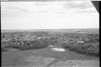
Cudworth
-
Description
-
Aerial photograph of a small town containing several grain elevators which is surrounded by farmland. A slew is visible towards the center of the image.
-
-
Title
-
Demaine
-
Description
-
Aerial photograph of a small town containing several grain elevators. An expanse of farmland is visible in the background.
-
Date
-
, 1955
-
-
Title
-
Forgan
-
Description
-
Aerial photograph of a small town containing two grain elevators. An expanse of farmland is visible in the background.
-
-
Title
-
Eatonia
-
Description
-
Aerial photograph of a small town with several grain elevators. An expanse of farmland is visible in the background.
-
-
Title
-
Gull Lake
-
Description
-
Aerial photograph of a small town with agricultural land in the background.
-
-
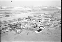
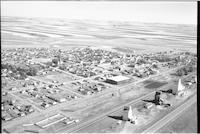
Title
-
Hodgeville
-
Description
-
Aerial photograph of a village. Approximately half of the picture is the surrounding farm land. A church, the railroad, and several grain elevators are visible.
-
Date
-
, 1955
-
-
Title
-
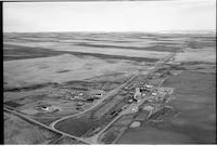
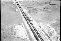
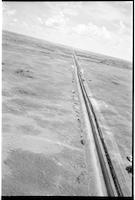
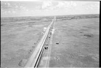
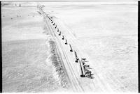
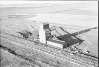
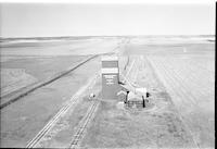
pipeline: Trans Canada 18 miles south of Lancer
-
Description
-
Aerial photograph of the construction of the Trans Canada pipeline, 18 miles south of Lancer.
-
Date
-
, 1956
-
-
Title
-
Matador
-
Description
-
Aerial photograph of a hamlet with a field of wheat to the left, and a dirt road running through it.
-
-
Title
-
Hodgeville
-
Description
-
Aerial photograph of a village with farm land in the distance. The main street of the town is easily visible, as are a church, the railroad, and several grain elevators.
-
Date
-
, 1955
-
-
Title
-
pipeline: Trans Canada 18 miles south of Lancer
-
Description
-
Aerial photograph of the construction of the Trans Canada pipeline, 18 miles south of Lancer.
-
Date
-
, 1956
-
-
Title
-
pipeline: Trans Canada 18 miles south of Lancer
-
Description
-
Aerial photograph of the construction of the Trans Canada pipeline, 18 miles south of Lancer.
-
Date
-
, 1956
-
-
Title
-
Pambrun
-
Description
-
Aerial photograph of a town. To the left is extensive farmland.
-
-
Title
-
pipeline: Trans Canada 18 miles south of Lancer
-
Description
-
Aerial photograph of the construction of the Trans Canada pipeline, 18 miles south of Lancer.
-
Date
-
, 1956
-
-
Title
-
Herbert
-
Description
-
Aerial photograph of a town surrounded by farm land.
-
-
Title
-
Neidpath
-
Description
-
Aerial photograph of a small hamlet surrounded by farmland.
-
Date
-
, 1955
-

-
Title
-
Neville
-
Description
-
Aerial photograph of a small village with farm land stretching into the distance.
-
-
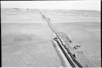
Title
-
pipeline: Trans Canada 18 miles south of Lancer
-
Description
-
Aerial photograph of the construction of the Trans Canada pipeline, 18 miles south of Lancer. A group of cattle is curiously investigating the pipes before they are put in the ground.
-
Date
-
, 1956
-
-
Title
-
Neville
-
Description
-
Aerial photograph of a small village surrounded by farm land. The railroad is the most dominant feature.
-
-
Title
-
Plato
-
Description
-
Aerial photograph of a small agricultural town. An expanse of farmland is visible in the background.
-
Date
-
, 1956
-
-
Title
-
Prelate
-
Description
-
Aerial photograph of an agricultural village. An expanse of farmland is visible in the background.
-
Date
-
, 1955
-
-
Title
-
Portreeve
-
Description
-
Aerial photograph of an agricultural village. An expanse of farmland is visible in the background.
-
Date
-
, 1955
-
-
Title
-
Plato
-
Description
-
Aerial photograph of a small agricultural town. An expanse of farmland is visible in the background.
-
Date
-
, 1956
-
-
Title
-
White Bear
-
Description
-
Aerial photograph of a hamlet surrounded by farmland.
-
Date
-
, 1956
-

-
Title
-
Mantario
-
Description
-
Aerial photograph of a hamlet.
-
Date
-
, 1956
-

-
Title
-
Arbuthnot
-
Description
-
Aerial photograph of a small hamlet. Two grain elevators next to a set of railroad tracks are situated to the right side. An expanse of farmland is visible in the background. This image was featured on page 103 of the 2010 publication entitled "Portraits of an Era; The Aerial Photography of Howdy McPhail", written by Bill Waiser and published by Fifth House.
-
Date
-
, 1960
-
-
Title
-
McMorran
-
Description
-
Aerial photograph of a community dominated by farmland.
-
Date
-
, 1956
-
-
Title
-
Hazenmore
-
Description
-
Aerial photograph of a small town containing several grain elevators, which is surrounded by farmland.
-
Date
-
, 1960
-
-
Title
-
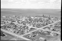
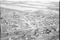
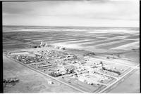
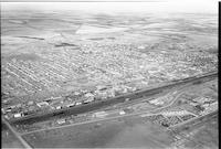
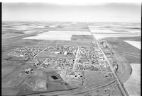
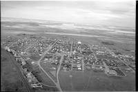
Swift Current
-
Description
-
Aerial photograph of a small city situated around the Swift Current Creek. An expanse of farmland is visible in the background.
-
Date
-
, 1955
-
-
Title
-
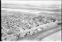
Elrose
-
Description
-
Aerial photograph of a small town. An expanse of farmland is visible in the background, and the wing of the airplane the photograph was taken from is visible in the top left corner of the image.
-
Date
-
, 1960
-

-
Title
-
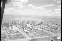
Maple Creek
-
Description
-
Aerial photograph of a small town containing several grain elevators. An expanse of farmland is visible in the background.
-
Date
-
, 1960
-
-
Title
-
Battrum
-
Description
-
Aerial photograph of a small town containing three grain elevators which is surrounded by farmland.
-
-
Title
-
Kyle
-
Description
-
Aerial photograph of a small town containing several grain elevators, which is surrounded by farmland.
-
Date
-
, 1960
-

-
Title
-
Mantario
-
Description
-
Aerial photograph of a hamlet near a large body of water.
-
Date
-
, 1956
-
-
Title
-
Waldeck
-
Description
-
Aerial photograph of a village surrounded by and expanse of farmland.
-
-
Title
-
Gull Lake
-
Description
-
Aerial photograph of a small town with several grain elevators. An expanse of farmland is visible in the background.
-
Date
-
, 1960
-

-
Title
-
Madison
-
Description
-
Aerial photograph of a small town with several grain elevators and an expanse of farmland in the background.
-
Date
-
, 1959
-
-
Title
-
Wartime
-
Description
-
Aerial photograph of a hamlet surrounded by an expanse of treeless farmland.
-
Date
-
, 1956
-
-
Title
-
Sandgren
-
Description
-
Aerial photograph of an unincorporated area surrounded by farmland.
-
Date
-
, 1956
-
-
Title
-
Wartime
-
Description
-
Aerial photograph of the grain outside the village of Wartime.
-
Date
-
, 1956
Pages


