Error message
Warning: count(): Parameter must be an array or an object that implements Countable in theme_pager_link() (line 637 of /opt/rh/httpd24/root/var/www/html/drupal/web/includes/pager.inc).
Search results
Pages
-
-
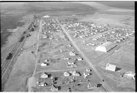
Title
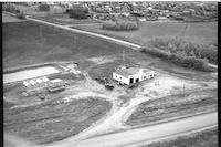
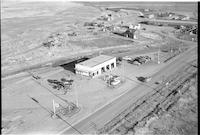
-
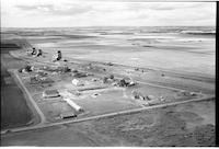
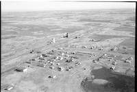
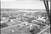
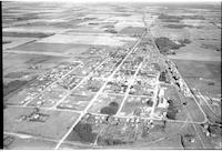
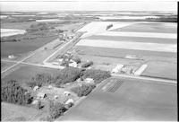
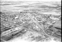
Paynton
-
Description
-
Aerial photograph of "Petty's Esso Service" and "Imperial" service station in the village of Payton, Saskatchewan.
-
Date
-
, 1956
-
-
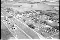
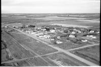
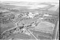
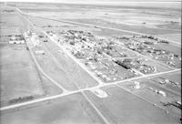
Title
-
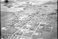
Parkside
-
Description
-
Aerial photograph of an agricultural village. An expanse of farmland is visible in the background.
-
-
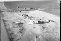
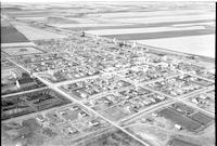
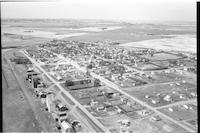
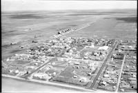
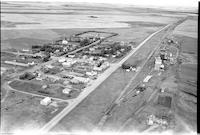
Title
-
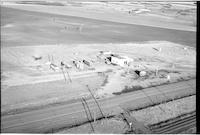
North Battleford
-
Description
-
Aerial photograph of Townmann's Service Station. Trailers, billboards, telephone poles, cattle and agricultural land visible in background.
-
Date
-
, 1955
-
-
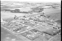
Title
-
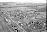
Oban
-
Description
-
Aerial photograph of a small community. An expanse of farmland is visible in the background.
-
-
Title
-
LaFleche
-
Description
-
Aerial photograph of a hamlet with a beautiful park in the bottom left hand side of the photograph.
-
Date
-
, 1955
-
-
Title
-
Muenster
-
Description
-
Aerial photograph of a small town. An expanse of farmland is visible in the background.
-

-
Title
-
Muenster
-
Description
-
Aerial photograph of a small town. An expanse of farmland is visible in the background.
-
-
Title
-
Horizon
-
Description
-
Aerial photograph of a hamlet surrounded by farm land. The dominant features are a church, several grain elevators, and the railroad.
-
Date
-
, 1955
-
-
Title
-
Hallonquist
-
Description
-
Aerial photograph of a hamlet, near a slough.
-
Date
-
, 1955
-
-
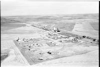
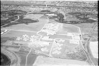
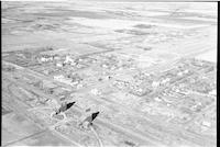
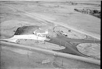
Title
-
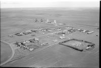
Moose Jaw: School for the Mentally Deficient
-
Description
-
Aerial photograph of the School for the Mentally Deficient, later called the Saskatchewan Training School and Valley View Centre, near Moose Jaw. Since the facility opened in 1955, the buildings seen are quite new. The city of Moose Jaw and the Moose Jaw River are visible to the north.
-
-
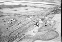
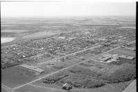
Title
-
Melfort
-
Description
-
Aerial photograph of a large town with an expanse of farm land in the distance. The school is the dominant feature.
-
Date
-
, 1955
-
-
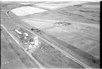
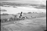
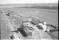
Title
-
Golburn
-
Description
-
Aerial photograph of a grain elevator with railway tracks with agricultural land surrounding it.
-
Date
-
, 1956
-

-
Title
-
Outlook
-
Description
-
Aerial photograph of a small town next to the South Saskatchewan River. An expanse of farmland is visible in the background.
-
-
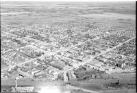
Title
-
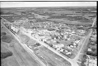
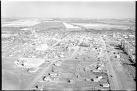
North Battleford
-
Description
-
Aerial photograph of a small town with streets, hotel, vehicles, schools and a water tower. A train bridge is also visible.
-
-
Title
-
Ethelton
-
Description
-
Aerial photograph of a small town with houses, a church, grain elevators with an expanse of agricultural land in background.
-
-
Title
-
Langham
-
Description
-
Aerial photograph of a small town with a church, school, grain elevators, railway tracks, access roads, false fronts and agricultural land visible in background.
-
Date
-
, 1955
-
-
Title
-
Limerick
-
Description
-
Aerial photograph of a small town with churches, dwellings, grain elevators, railway tracks and a school. Agricultural land is visible in the background.
-
Date
-
, 1955
-
-
Title
-
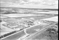
North Battleford
-
Description
-
Aerial photograph of a B.A. service station, a few trailers, a highway and cattle and agricultural land in the background.
-
Date
-
, 1955
-
-
Title
-
Froude
-
Description
-
Aerial photograph of a hamlet with a church and a school, grain elevators with agricultural land visible in background.
-

-
Title
-
Outlook
-
Description
-
Aerial photograph of a small town. An expanse of farmland is visible in the background.
-
-
Title
-
Luseland
-
Description
-
Aerial photograph of a small town with an expanse of farm land in the distance. Main Street and grain elevators are the dominant features.
-
-
Title
-
Osler
-
Description
-
Aerial photograph of a small town. An expanse of farmland is visible in the background.
-
-
Title
-
Forget
-
Description
-
Aerial photograph of a village surrounded by farm land. A church, rectory, and other religious buildings are visible, as is the main street, the railroad, and grain elevators.
-
Date
-
, 1955
-
![Willowbunch [Willow Bunch]](/islandora/object/mcphail%3A1296/datastream/TN/view)
-
Title
-
Willowbunch [Willow Bunch]
-
Description
-
Aerial photograph of a small community with gentle, rolling hills behind it.
-
Date
-
, 1955
-
-
Title
-
Sturgis
-
Description
-
Aerial photograph of town surrounded by farmland dotted with trees.
-
Date
-
, 1956
-
-
Title
-
Weyburn
-
Description
-
Aerial photograph of a mental hospital surrounded by clusters of trees.
-
Date
-
, 1955
-
-
Title
-
Torquay
-
Description
-
Aerial photograph of an agricultural village with a vast expanse of farm land in he background.
-
-
Title
-
Torquay
-
Description
-
Aerial photograph of an agricultural village surrounded by farmland.
-
-
Title
-
Shellbrook
-
Description
-
Aerial photograph of a well-sized rural community. An expanse of farmland is visible in the background.
-
-
Title
-
Springwater
-
Description
-
Aerial photograph of an agricultural hamlet on the Prairies.
-

-
Title
-
Speers
-
Description
-
Aerial photograph of a village surrounded by an expanse of farmland.
-

-
Title
-
Stoughton
-
Description
-
Aerial photograph of a small agricultural town. An expanse of farmland is visible in the background.
-
Date
-
, 1955
-
-
Title
-
Veregin
-
Description
-
Aerial photograph of a village surrounded by farmland.
-
Date
-
, 1956
-
-
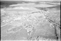
Title
-
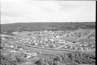
Paradise Hill
-
Description
-
Aerial photograph of the village of Paradise Hill, showing surrounding forested rolling hills, farmland and a lake.
-
-
Title
-
Shellbrook
-
Description
-
Aerial photograph of a well-sized rural community. An expanse of farmland is visible in the background.
-
-
Title
-
Tway
-
Description
-
Aerial photograph of a hamlet surrounded by farm land. A school, church, and railroad are easily visible.
-
-
Title
-
Paradise Hill
-
Description
-
Aerial photograph of the village of Paradise Hill, showing surrounding forested rolling hills.
-
-
Title
-
Sheho
-
Description
-
Aerial photograph of a well-sized agricultural community.
-
-
Title
-
Resource
-
Description
-
Aerial photograph of a community dominated by farmland.
-
-
Title
-
Vantage
-
Description
-
Aerial photograph of hamlet with a vast expanse of farmland in the background.
-
Date
-
, 1956
-

-
Title
-
Star City
-
Description
-
Aerial photograph of a large town in Saskatchewan.
-
Date
-
, 1955
-
-
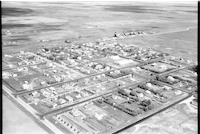
Title
-
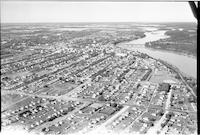
Prince Albert
-
Description
-
Aerial photograph of a city with a river running through it.
-
-
Title
-
Raymore
-
Description
-
Aerial photograph of a town with farmland and clusters of trees in the background.
-
-
Title
-
Esso Service Station
-
Description
-
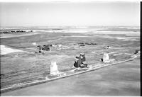
Aerial photograph of the Esso Service Station in Swift Current, Saskatchewan.
-
-
Title
-
Tallman
-
Description
-
Aerial photograph of two grain elevators and some houses in the middle of the Prairies.
-
-
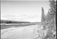
Title
-
Stony Rapids
-
Description
-
Aerial photograph of the landscape near Stony Rapids, a northern hamlet in Saskatchewan.
-
-
Title
-
North Star Oil: service station
-
Description
-
Aerial photograph of North Star Oil service station. Several vehicles are parked nearby.
-
-
Title
-
Stoughton
-
Description
-
Aerial photograph of a small town surrounded by farmland.
-
Date
-
, 1955
-
-
Title
-
Tate
-
Description
-
Aerial photograph of a rural hamlet surrounded by farmland.
-
-
Title
-
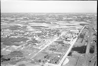
Tisdale
-
Description
-
Aerial photograph of a small town and agricultural business center. An expanse of farmland is visible in the background.
Pages


