Search results
Pages
-
-
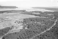
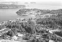
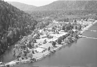
Title
-
Fanny Bay
-
Description
-
Aerial photograph of Fanny Bay, a hamlet on the east coast of Vancouver Island, British Columbia. The Pacific Ocean is visible in the background.
-
Date
-
1958
-
-
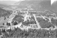
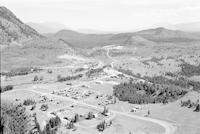
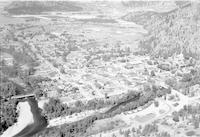
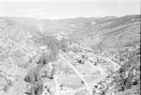
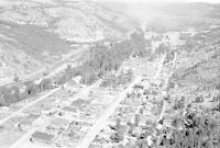
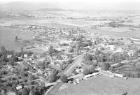
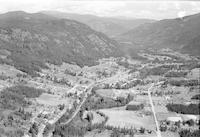
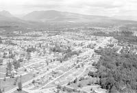
Title
-
Falkland
-
Description
-
Aerial photograph of Falkland, a community in central British Columbia.
-
Date
-
1958
-
-
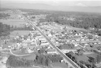
Title
-
Aldergrove
-
Description
-
Aerial photograph of Aldergrove, British Columbia.
-
Date
-
1958
-
-
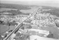
Title
-
Aldergrove
-
Description
-
Aerial photograph of Aldergrove, British Columbia.
-
Date
-
1958
-
-
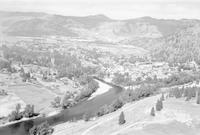
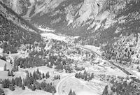
Title
-
Elko
-
Description
-
Aerial photograph of Elko, a town located on the Elk Valley in the Kootenay region of British Columbia.
-
Date
-
1957
-
-
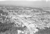
Title
-
Enderby
-
Description
-
Aerial photograph of Enderby, a city in the North Okanagan Region of British Columbia.
-
Date
-
1958
-

-
Title
-
Enderby
-
Description
-
Aerial photograph of Enderby, a city in the North Okanagan Region of British Columbia.
-
Date
-
1958
-
-
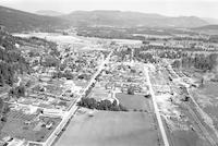
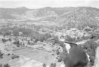
Title
-
Erickson
-
Description
-
Aerial photograph of Erickson, a community in southern British Columbia, two miles east of Creston.
-
Date
-
1957
-
-
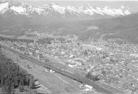
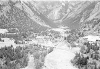
Title
-
Fernie
-
Description
-
Aerial photograph of Fernie, a city in eastern British Columbia. The Rocky Mountain Trench is visible in the background.
-
Date
-
1958
-
-
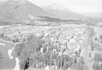
Title
-
Fernie
-
Description
-
Aerial photograph of Fernie, a city in eastern British Columbia. The Rocky Mountain Trench is visible in the background.
-
Date
-
1958
-
-
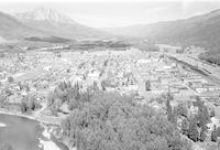
Title
-
Fernie
-
Description
-
Aerial photograph of Fernie, a city in eastern British Columbia. The Rocky Mountain Trench is visible in the background.
-
Date
-
1957
-
-
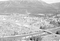
Title
-
Fernie
-
Description
-
Aerial photograph of Fernie, a city in eastern British Columbia. The Rocky Mountain Trench is visible in the background.
-
Date
-
1957
-
-
Title
-
Fernie
-
Description
-
Aerial photograph of Fernie, a city in eastern British Columbia. The Rocky Mountain Trench is visible in the background.
-
Date
-
1957
-
-
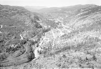
Title
-
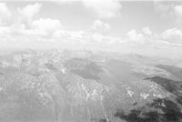
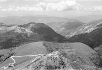
fire tower; mountains
-
Description
-
Aerial photograph of a range of mountains north of Ripple Mountain in the south of British Columbia.
-
-
Title
-
fire tower; mountains
-
Description
-
Aerial photograph of a range of mountains north of Ripple Mountain in the south of British Columbia.
-
-
Title
-
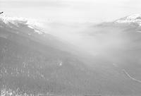
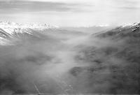
forest fire
-
Description
-
Aerial photograph of a forest fire south of Valemount, Britsh Columbia.
-
Date
-
1958
-
-
Title
-
forest fire
-
Description
-
Aerial photograph of a forest fire south of Valemount, Britsh Columbia.
-
Date
-
1958
-
-
Title
-
Fort Langley
-
Description
-
Aerial photograph of Fort Langley, a village in the Lower Mainland of British Columbia.
-
Date
-
1958
-
-
Title
-
Fort Langley
-
Description
-
Aerial photograph of Fort Langley, a village in the Lower Mainland of British Columbia.
-
Date
-
1957
-
-
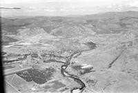
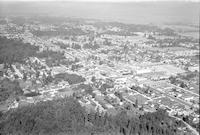
Title
-
Grand Forks
-
Description
-
Aerial photograph of Grand Forks, a city in the West Kootenay Region on British Columbia.
-
Date
-
1957
-
-
Title
-
Grand Forks
-
Description
-
Aerial photograph of Grand Forks, a city in the West Kootenay Region on British Columbia.
-
Date
-
1957
-
-
Title
-
Grand Forks
-
Description
-
Aerial photograph of Grand Forks, a city in the West Kootenay Region on British Columbia.
-
Date
-
1957
-
-
Title
-
Grand Forks
-
Description
-
Aerial photograph of Grand Forks, a city in the West Kootenay Region on British Columbia.
-
Date
-
1957
-
-
Title
-
Grand Forks
-
Description
-
Aerial photograph of Grand Forks, a city in the West Kootenay Region on British Columbia.
-
Date
-
1958
-
-
Title
-
Gray Creek
-
Description
-
Aerial photograph of Gray Creek, British Columbia.
-
Date
-
1957
-
-
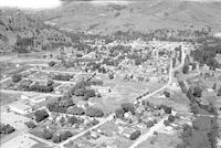
Title
-
Greenwood
-
Description
-
Aerial photograph of Greenwood, a city in south central British Columbia.
-
Date
-
1957
-
-
Title
-
Greenwood
-
Description
-
Aerial photograph of Greenwood, a city in south central British Columbia.
-
Date
-
1957
-
-
Title
-
Greenwood
-
Description
-
Aerial photograph of Greenwood, a city in south central British Columbia.
-
Date
-
1958
-
-
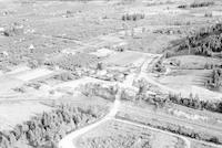
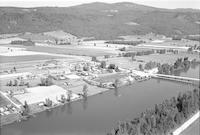
Title
-
Grindrod
-
Description
-
Aerial photograph of Grindrod, a community in the Okanagan Region of British Columbia.
-
Date
-
1958
-
-
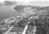
Title
-
Gibson's Landing
-
Description
-
Aerial photograph of Gibsons, a coastal community in southwestern British Columbia formerly known as Gibson's Landing.
-
Date
-
1958
-
-
Title
-
Gibson's Landing
-
Description
-
Aerial photograph of Gibsons, a coastal community in southwestern British Columbia formerly known as Gibson's Landing.
-
Date
-
1958
-
-
Title
-
Glendale
-
Description
-
Aerial photograph of a community in British Columbia.
-
Date
-
1958
-
-
Title
-
Fort Steele
-
Description
-
Aerial photograph of Fort Steele, a town in the Kootenay Region of British Columbia.
-
Date
-
1957
-
-
Title
-
Fruitvale
-
Description
-
Aerial photograph of Fruitvale, a village in south-eastern British Columbia.
-
Date
-
1957
-
-
Title
-
Ganges
-
Description
-
Aerial photograph of Ganges, a community on Salt Spring Island in the province of British Columbia.
-
Date
-
1958
-
-
Title
-
Ganges
-
Description
-
Aerial photograph of Ganges, a community on Salt Spring Island in the province of British Columbia.
-
Date
-
1958
-
-
Title
-
Ganges
-
Description
-
Aerial photograph of Ganges
-
Date
-
1958
-
-
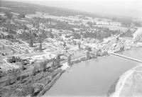
Title
-
Hammond
-
Description
-
Aerial photograph of Port Hammond, a community in British Columbia. The Fraser River is visible in the foreground.
-
Date
-
1958
-
-
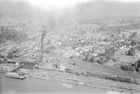
Title
-
Hammond
-
Description
-
Aerial photograph of Port Hammond, a community on the Fraser River in British Columbia. Smoke is visible in the upper left corner coming out from a factory.
-
Date
-
1958
-
-
Title
-
Hammond
-
Description
-
Aerial photograph of Port Hammond, a community in British Columbia. The Fraser River is visible in the foreground.
-
Date
-
1958
-
-
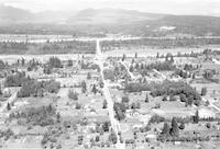
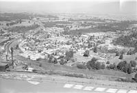
Title
-
Haney
-
Description
-
Aerial photograph of Haney, the downtown core of the city of Maple Ridge, British Columbia.
-
Date
-
1957
-
-
Title
-
Hedley
-
Description
-
Aerial photograph of Hedley, a town in southern British Columbia.
-
Date
-
1958
-
-
Title
-
Hedley
-
Description
-
Aerial photograph of Hedley, a town in southern British Columbia.
-
Date
-
1958
-
-
Title
-
Haney
-
Description
-
Aerial photograph of Haney, the downtown core of the city of Maple Ridge, British Columbia.
-
Date
-
1958
-
-
Title
-
Haney
-
Description
-
Aerial photograph of Haney, the downtown core of the city of Maple Ridge, British Columbia.
-
Date
-
1958
-
-
Title
-
Haney
-
Description
-
Aerial photograph of Haney, the downtown core of the city of Maple Ridge, British Columbia.
-
Date
-
1957
-
-
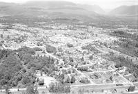
Title
-
Haney
-
Description
-
Aerial photograph of Haney, the downtown core of the city of Maple Ridge, British Columbia. The Fraser River is visible in the background.
-
Date
-
1958
-
-
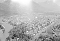
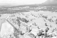
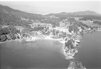
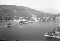
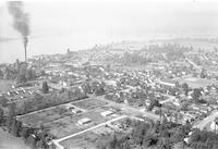
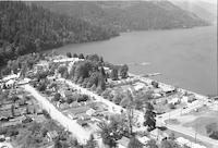
Title
-
Harrison Hot Springs
-
Description
-
Aerial photograph of Harrison Hot Springs, a small community in the Fraser Valley of British Columbia. Harrison Lake is visible in the right side of the photograph. A range of mountains is visible in the background.
-
Date
-
1958
-
-
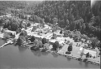
Title
-
Harrison Hot Springs
-
Description
-
Aerial photograph of Harrison Hot Springs, a small community in the Fraser Valley of British Columbia. Harrison Lake is visible in the foreground.
-
Date
-
1958
-
-
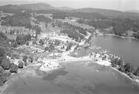
Title
-
Harrison Hot Springs
-
Description
-
Aerial photograph of Harrison Hot Springs, a small community in the Fraser Valley of British Columbia.
-
Date
-
1958
Pages


